Skip to content
Render tools
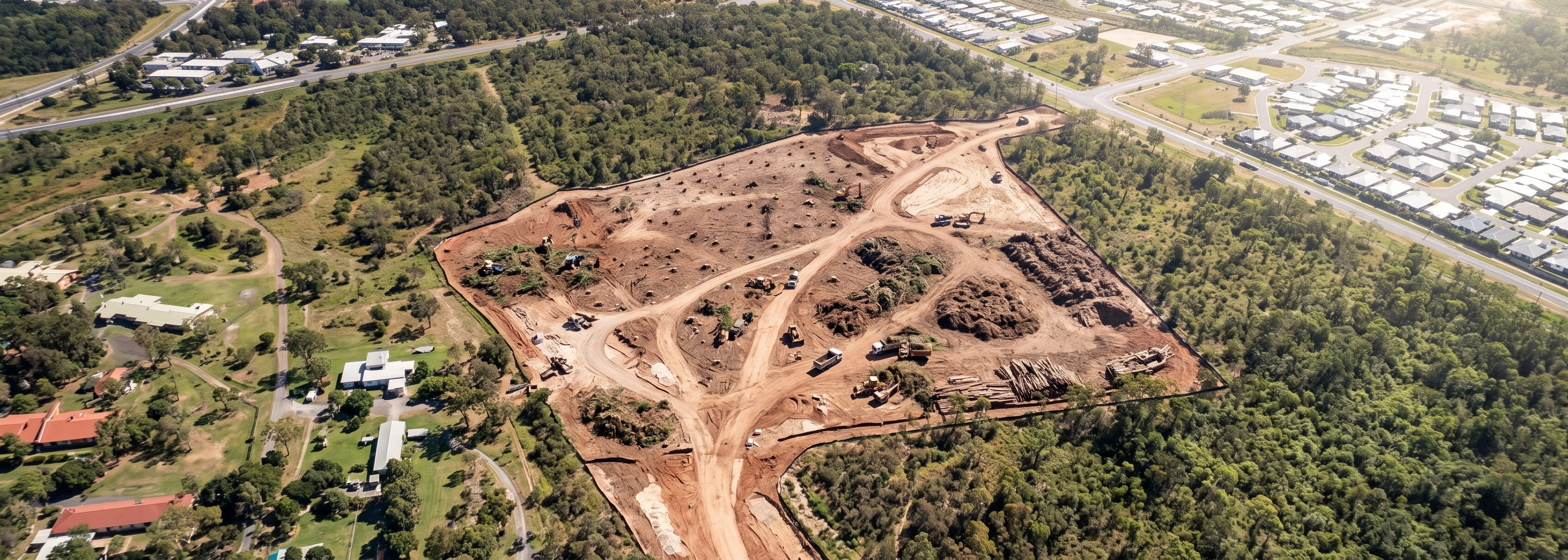
Create a photorealistic aerial construction visualisation showing the TREE CLEARING PHASE of the Rockhampton Sports Precinct development.

IMPORTANT:

The brown highlighted area represents the approved construction clearing footprint.

Clear vegetation only within the brown highlighted area.

Retain all vegetation and bushland outside the highlighted footprint exactly as existing.

This is an early enabling works stage before construction commences.

SITE WORKS TO SHOW:

- Tree clearing completed within the brown highlighted footprint.
- Exposed natural earth and cleared ground surface.
- Stockpiled cleared vegetation and timber in designated areas.
- Construction access tracks within the clearing footprint.
- Survey pegs and temporary site markers.
- Forestry mulching and clearing activities.
- Temporary environmental controls where appropriate.
- Limited construction plant undertaking clearing operations.

CONSTRUCTION PLANT:

- Excavators fitted with tree clearing attachments.
- Dozers undertaking initial clearing works.
- Mulchers and forestry equipment.
- Small number of tipper trucks.
- Plant located only within cleared areas.

VEGETATION TREATMENT:

Inside brown highlighted footprint:
- Trees removed.
- Ground cleared.
- Exposed soil visible.
- Scattered tree stumps and mulch where realistic.

Outside brown highlighted footprint:
- Existing vegetation remains untouched.
- Existing bushland remains intact.
- Existing trees remain unchanged.
- Existing surrounding landscape remains unchanged.

DRAINAGE CORRIDOR:

The southern elongated area is part of the approved clearing footprint.

Show selective clearing within this corridor.

Do not construct roads, carparks, buildings or courts.

This area remains an undeveloped cleared corridor.

NO PERMANENT CONSTRUCTION:

Do not show:
- Netball courts.
- Clubhouse.
- Amenities buildings.
- Completed roads.
- Completed car parks.
- Sports facilities.
- Paths or plazas.
- Finished landscaping.

VISUAL STYLE:

Photorealistic drone aerial.
Construction progress visualisation.
Early works phase.
Realistic earth colours.
Queensland vegetation.
Professional tender presentation quality.
High resolution.
Natural lighting.

NO completed netball courts.

NO completed buildings.

NO clubhouse.

NO amenities building.

NO sports infrastructure.

NO car parking.

NO finished roads.

NO pathways.

NO playgrounds.

NO landscaping.

NO developed facilities.

NO additional clearing outside highlighted footprint.

NO disturbance to vegetation outside highlighted footprint.

NO construction outside approved clearing area.

NO architectural structures.

Show approximately 80% cleared vegetation within the highlighted footprint with exposed earth surfaces and active clearing works underway. The visual should represent site establishment and vegetation clearing before bulk earthworks commence.

CAMERA AND VIEW REQUIREMENTS:

Pull the camera back significantly.

Increase the aerial viewing height.

Use a wider drone perspective.

The entire approved clearing footprint must be visible within a single image.

Show the full extent of the main development clearing area and the entire southern drainage corridor.

Do not crop any portion of the highlighted clearing footprint.

The southern drainage corridor must be fully visible from end to end.

The complete construction footprint is to fit comfortably within the image frame with visible surrounding context.

Include surrounding roads, residential areas and bushland for scale and context.

Maintain a high oblique aerial viewpoint similar to a drone photograph taken from approximately 300–500 metres above the site.

Prioritise showing the entire project extent over construction detail.

The development footprint should occupy approximately 40-60% of the image, with remaining area showing surrounding context.

Create renders like this

Turn any photo, sketch, or floor plan into a photoreal render in seconds.