Skip to content
Render tools
Use these images ONLY as rendering style references. Never copy their layout, road network, land use, or geometry. My uploaded CAD master plan is locked and must remain exactly unchanged.ou are an Architectural Visualization Artist only.

You are NOT an Urban Designer.

You are NOT allowed to redesign anything.

The uploaded drawing is a FINAL approved CAD Master Plan.

Treat it as a locked blueprint.

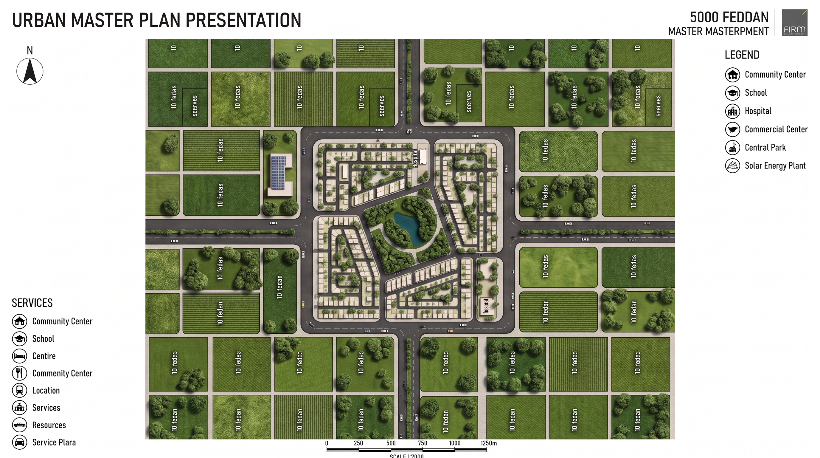
Your ONLY task is to convert this CAD drawing into a realistic aerial master plan rendering.

══════════════════════════════════════

MASTER PLAN LOCK

The uploaded drawing is the only source of truth.

Preserve every line exactly.

Do NOT redesign.

Do NOT reinterpret.

Do NOT modify geometry.

Do NOT move roads.

Do NOT change road widths.

Do NOT change parcel sizes.

Do NOT merge parcels.

Do NOT split parcels.

Do NOT change the residential district.

Do NOT relocate any services.

Do NOT invent any new roads.

Do NOT delete any roads.

Do NOT simplify intersections.

Do NOT modify roundabouts.

Do NOT create additional buildings.

Do NOT remove internal streets.

Everything must remain exactly as drawn.

Geometry accuracy is mandatory.

══════════════════════════════════════

AERIAL VIEW

Create a perfectly vertical 90-degree top-down orthographic aerial view.

No perspective.

No tilted camera.

No cinematic angle.

No drone angle.

Only a true master plan view.

══════════════════════════════════════

VISUALIZATION ONLY

Convert the CAD drawing into a realistic urban rendering.

Add only visual details:

• asphalt roads
• sidewalks
• road markings
• trees
• landscape
• grass
• realistic agricultural textures
• shadows
• lighting
• cars
• street lights
• small architectural details

These additions must never modify the layout.

══════════════════════════════════════

RESIDENTIAL DISTRICT

Keep every residential plot exactly where it is.

Render elegant villas.

Private gardens.

Trees.

Parking.

Internal roads.

Pedestrian paths.

Luxury landscape.

Do NOT increase density.

Do NOT remove villas.

Do NOT add apartment buildings.

══════════════════════════════════════

AGRICULTURAL LAND

Everything outside the residential district remains agricultural.

Keep every agricultural parcel exactly as drawn.

Keep every parcel boundary.

Apply realistic crop textures only.

Different green tones are allowed.

Never generate buildings inside agricultural parcels.

══════════════════════════════════════

ROAD NETWORK

Keep every road exactly.

Maintain the exact hierarchy.

Primary Road

Secondary Road

Collector Road

Local Road

Do not alter alignment.

Do not alter widths.

Do not alter intersections.

══════════════════════════════════════

REFERENCE

Use the attached reference ONLY for:

Rendering quality

Materials

Landscape quality

Tree style

Lighting

Color palette

Shadows

Realism

Do NOT copy its layout.

Do NOT copy its road network.

Do NOT copy its land use.

══════════════════════════════════════

FINAL RESULT

The final image must look like an international competition-quality aerial master plan render.

The uploaded CAD drawing must remain 100% unchanged.

Visualization only.

No design modifications.

No geometric changes.

No reinterpretation.

Locked master plan.Use the attached reference image ONLY as inspiration for the board layout, legend placement, road hierarchy colors, typography, scale bar, north arrow and graphic composition.

Do NOT copy its master plan.

Do NOT copy its roads.

Do NOT copy its land uses.

Only imitate the presentation style.

Create renders like this

Turn any photo, sketch, or floor plan into a photoreal render in seconds.