Skip to content
Render tools
Use the attached mosque image as the exact architectural base.

Do not change the mosque architecture in any way.

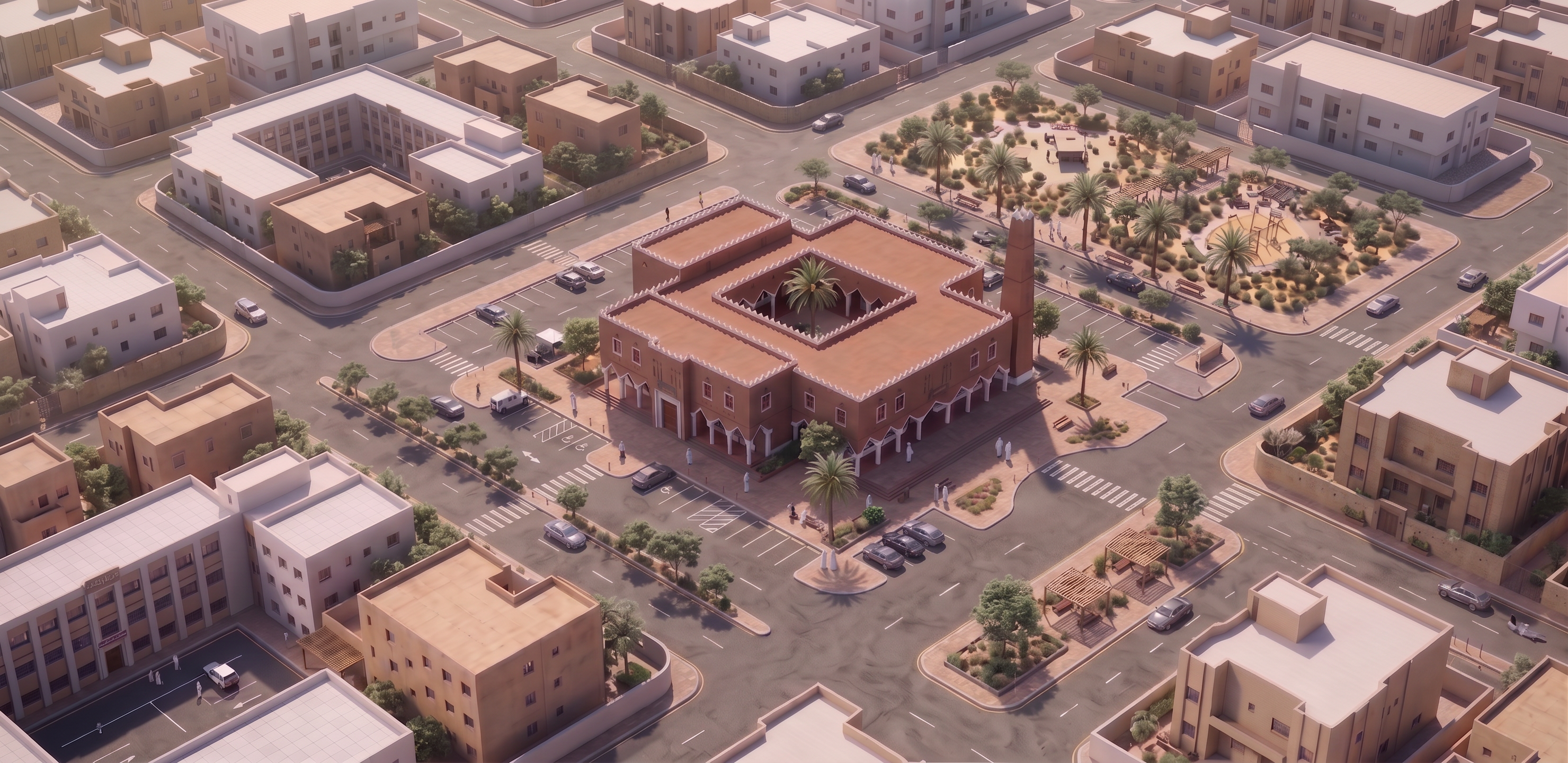
Create a wider top-isometric urban design view focusing on the STREET NETWORK and INTERSECTIONS surrounding the mosque.

The purpose of this image is to visually demonstrate how pedestrians arriving from the surrounding neighborhood naturally reach the mosque through the nearest intersections.

Design the surrounding streets so that 3–4 clear neighborhood pedestrian approaches converge toward the mosque.

The most important pedestrian approach points should occur at logical street intersections around the mosque.

At these key intersections provide:
- clearly positioned pedestrian crossings
- continuous sidewalks
- curb ramps
- shaded pedestrian routes
- safe transition from neighborhood sidewalk to mosque site
- landscape that visually guides movement
- clear sightlines toward the mosque
- pedestrian priority near the mosque

The mosque entrances must logically align with the strongest pedestrian arrival routes.

Do NOT randomly place zebra crossings on every street.

Crossings must occur where real pedestrian desire lines from the neighborhood would naturally meet the mosque site.

The image should visually communicate:

NEIGHBORHOOD
→ INTERSECTION
→ SAFE CROSSING
→ SHADED PEDESTRIAN PATH
→ MOSQUE PLAZA
→ MOSQUE ENTRANCE

Do not add text, arrows, labels, icons, colored lines, or infographic graphics.

Explain the movement entirely through realistic urban design.

Keep vehicular movement functional but secondary to pedestrian accessibility near the mosque.

Saudi neighborhood context.
Professional urban design visualization.
High-detail aerial isometric view.
Soft daylight.
Clean landscape architecture.
Same exact mosque from the reference.

Create renders like this

Turn any photo, sketch, or floor plan into a photoreal render in seconds.