Skip to content
Render tools
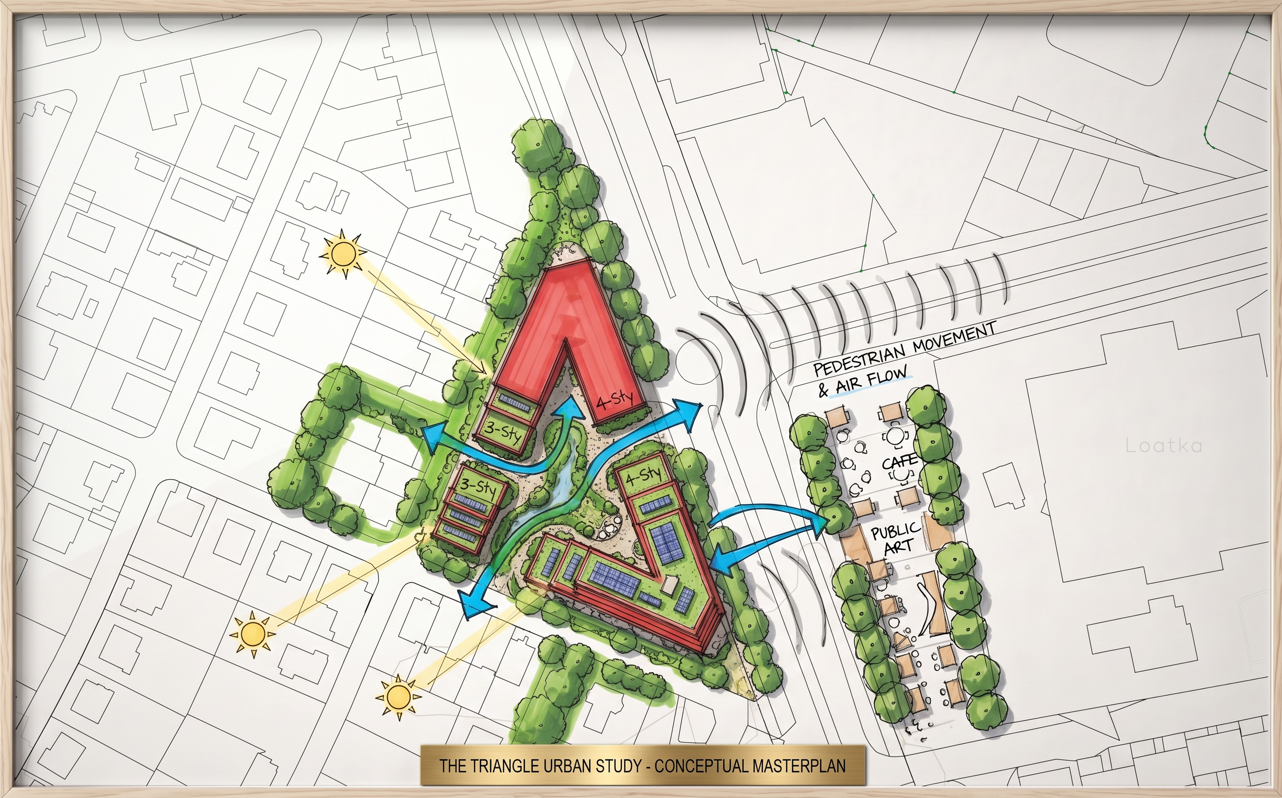
Refine and enhance the provided hand-drawn conceptual masterplan diagram (THE TRIANGLE URBAN STUDY). Keep the EXACT same building placement, V-shaped building geometries, site boundaries, and hand-sketched marker style, but elevate it with deeper architectural and urban details.   Specific Enhancements to Add:Building Volumes & Terracing: Enhance the 3D depth of the red V-shaped building masses. Show stepped rooftop terraces at the 3-storey ends (3-Sty) facing the western low-rise family houses, with green roofs and solar panels on top.   Pedestrian & Environmental Overlays:Retain and sharpen the blue directional arrows for PEDESTRIAN MOVEMENT & AIR FLOW passing diagonally through the central void between the two main V-blocks.   Add light yellow solar beam vectors coming from the southwest into the inner courtyards.   Add curved sound wave graphics along the eastern arterial road to illustrate how the V-masses block traffic noise.   Landscape & Ground Hierarchy:Expand the green marker wash around the western and southern perimeters to clearly show a lush buffer zone with mature trees separating the project from single-family homes.   Detail the central void with a rainwater retention bio-swale, meandering gravel pathways, and small outdoor seating pockets.   Public Realm & Street Connection: Detail the eastern streetscape facing the CAFE & PUBLIC ART zone across the road—show sidewalk tree avenues, outdoor cafe tables, and active ground-floor shopfronts.   Graphic Style:High-end architectural competition presentation sketch. Authentic hand-drawn feel using clean CAD vector line art underneath, crisp felt-tip marker overlays (vibrant red for buildings, green for landscape wash, blue for circulation arrows), professional handwritten typography annotations, framed presentation layout.  like a concept sketch from world architectual studio

Create renders like this

Turn any photo, sketch, or floor plan into a photoreal render in seconds.