Skip to content
Render tools
PRIMARY INSTRUCTION (MOST IMPORTANT)
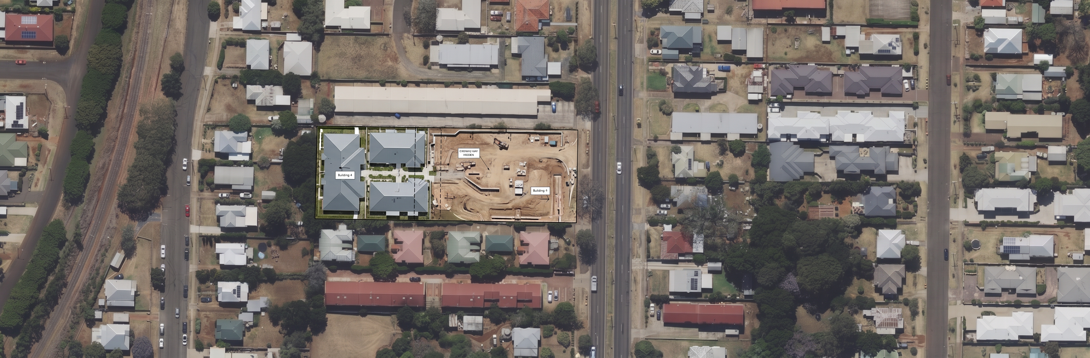
The supplied James Street aerial image is the master image and must remain 100% unchanged.
Use the aerial photograph as a locked background layer.
DO NOT regenerate, redraw, reinterpret or enhance:

Surrounding houses
Roads
Railway corridor
Trees and vegetation
Shadows
Vehicles
Neighbouring properties
Site boundaries
Existing aerial imagery

Only modify the proposed development overlay located within the project site boundary.
The final image must appear as though the development overlay has simply been edited directly onto the existing aerial photograph.

SITE STAGING
Illustrate Stage 1 construction only.
Building 4 and Building 2 are complete.
Show:

Finished roof structures
Completed façades
Windows installed
Finished pathways immediately surrounding the buildings
Minor landscaping around completed buildings

Building 1 and Building 3 are NOT complete.
All remaining areas are active construction zones.
Show:

Exposed earthworks
Working site dirt
Excavation areas
Retaining wall construction
Temporary access tracks
Material stockpiles
Small quantities of construction equipment

The site must clearly read as:
"Buildings 4 and 2 completed, remainder under construction."

RETAINING WALLS AND SITE LEVELS
Maintain the site's sloping nature.
Show retaining walls exactly as indicated in the design drawings.
Use stepped earthworks and level changes to communicate the site's fall across the development.
Do not flatten the site.
Do not introduce new retaining wall locations.

IMAGE STYLE
Photorealistic.
Construction methodology presentation quality.
Tender submission quality.
Architectural visualisation quality.
No artistic interpretation.
No conceptual redesign.
No masterplan rendering style.
No bird's-eye perspective.
No cinematic view.
No change to camera position.
Maintain exact orthographic top-down aerial view.

GEOMETRY LOCKING
Maintain exact:

Building footprints
Road alignments
Site boundary
Building locations
Path locations
Landscape locations
Retaining wall locations

No movement of any building is permitted.
No scaling of buildings is permitted.
No modification of surrounding context is permitted.
Edit only the construction status of the proposed development.

NEGATIVE PROMPT
Do not regenerate aerial imagery.
Do not redesign site layout.
Do not alter surrounding houses.
Do not alter roads.
Do not alter railway corridor.
Do not expand construction area beyond project boundary.
Do not create new buildings.
Do not change site dimensions.
Do not introduce perspective view.
Do not create masterplan style graphics.
Do not change camera angle.
Do not relocate retaining walls.
Do not complete Buildings 1 or 3.
Only edit the development overlay within the site boundary.

Additional Tip
If AI Render Studio has an "Image Strength", "Reference Strength", "Geometry Lock", "Structure Reference" or "Preserve Composition" setting:

Structure Reference = 100%
Composition Lock = Maximum
Geometry Preservation = Maximum
Creativity = Very Low (5–10%)
Prompt Influence = Medium
Use the James Street aerial as the Primary Image
Use the modular methodology PDF image as Style Reference Only

The biggest change from your original prompt is telling the software that the aerial is a locked photograph and that it may only edit the proposed development overlay. That's usually what stops it from rebuilding half the suburb.

Create renders like this

Turn any photo, sketch, or floor plan into a photoreal render in seconds.