Skip to content
Render tools
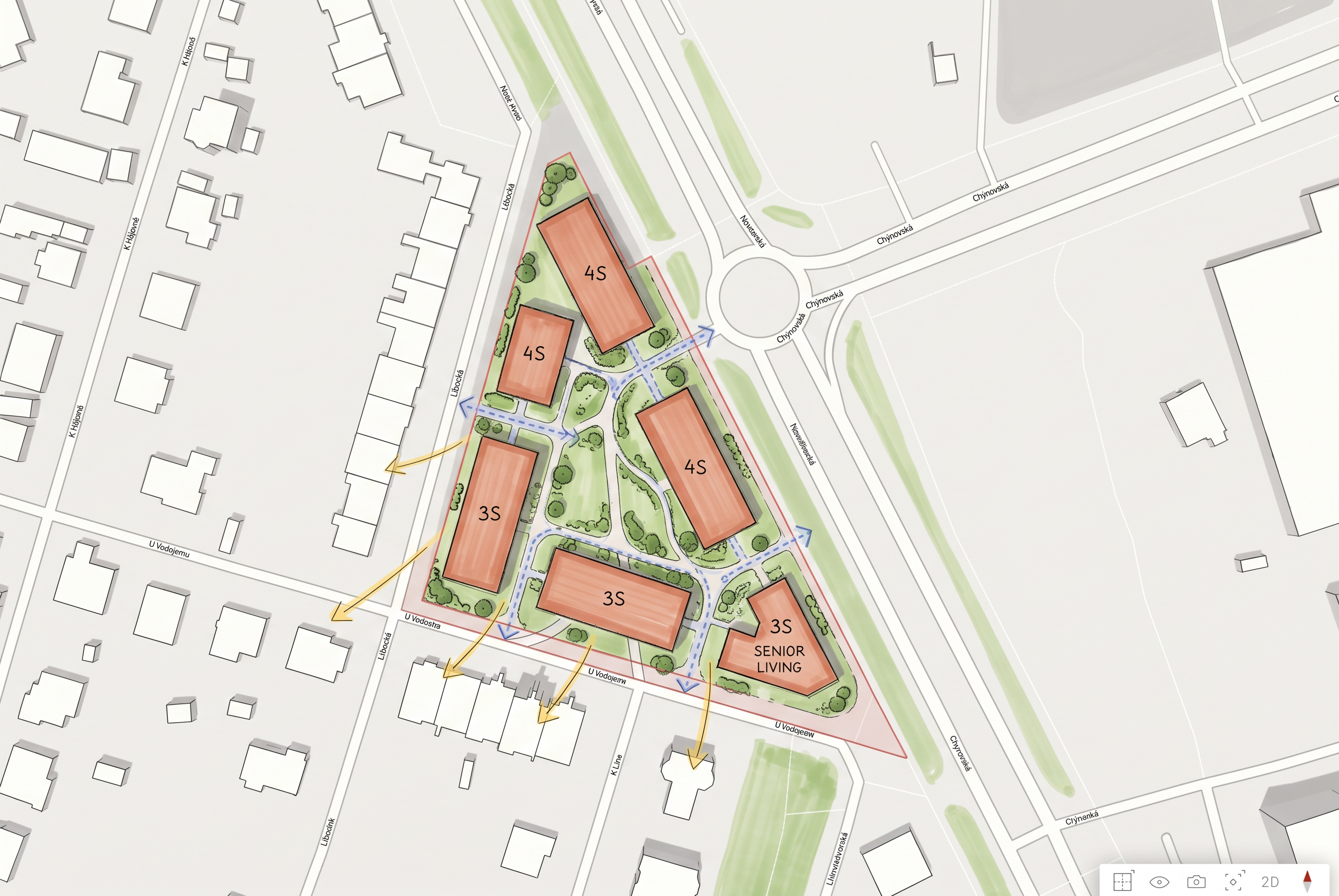
A clean 2D architectural masterplan site plan applying a modular urban grid strategy on the provided triangular plot context. The design strictly uses ONE repeated standardized residential building module footprint (dimensions approximately 28x14 meters) systematically arranged across the site.

STRICT MODULAR DISPOSITION RULES:

Modular Grid Layout: Place exactly 6 identical building footprints across the plot:

3 Eastern Modules (4S): Positioned along the eastern main road, slightly angled to break traffic noise and form inviting entrance portals to the site. Ground floor of these 3 modules features active retail, cafe seating, and shopfronts facing the transit hub.

3 Western/Southern Modules (3S): Positioned along the western boundary facing single-family homes, stepped down to 3 storeys with private ground-floor patio gardens facing a quiet buffer zone. One southern module is labeled for senior living.

Clear Spacing & Central Park: Maintain a consistent 18 to 20-meter gap between all repeated modules. The central core remains unbuilt as a continuous green park on natural ground with meandering pedestrian paths and mature tree clusters.

Diagrammatic Annotations:

Overlay blue dashed arrows showing pedestrian shortcuts cutting through the gaps between the identical modules toward the tram stops.

Yellow solar vectors pointing from southwest into the gaps.

Clear storey height badges (4S and 3S) on each identical building block footprint.

Graphic Style:

High-end architectural presentation masterplan visual. Clean CAD vector line art underneath merged with soft felt-tip marker overlays (terracotta/red for the repeated building footprints, lush green for the park wash, blue for pedestrian vectors, yellow for sunlight). Crisp handwritten typography labels, white background...you can only work and place the buldings in the red area in the middle nowhere else just strictly there

Create renders like this

Turn any photo, sketch, or floor plan into a photoreal render in seconds.