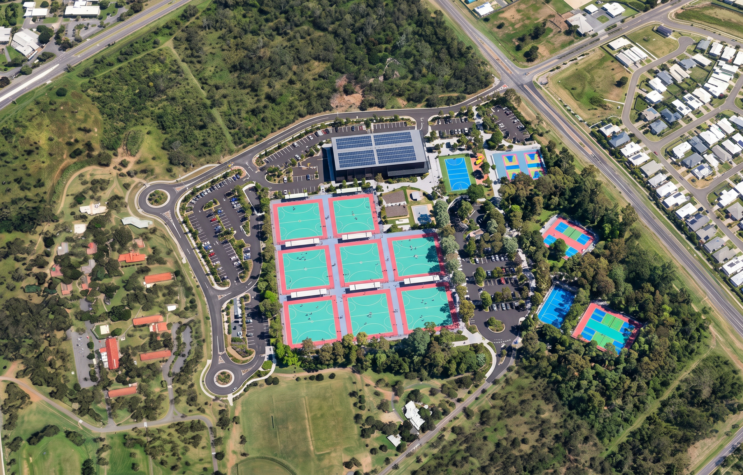
- Prompt
- Transform the supplied Rockhampton Sports Precinct masterplan aerial into a completed, photorealistic aerial render. CRITICAL: - Preserve the exact site geometry, layout, scale, orientation, boundaries and all built form shown in the supplied plan. - Do not move, resize, delete or add any buildings, courts, roads, pathways, carparks, landscaping zones, entry features or site infrastructure. - Use the uploaded architect renders as style and material references only. - Render only the elements shown on the masterplan. - Do not introduce any additional facilities, buildings, sporting infrastructure, play equipment, sculptures, shade structures, water features, vehicles, roads, pathways or landscape elements that are not shown in the original drawing. Do not alter site boundaries. Do not change court quantities or locations. Do not add buildings. Do not add sports fields. Do not add lakes, water features or fountains. Do not add additional carparks. Do not add additional pathways. Do not add playgrounds unless shown. Do not add public art. Do not add grandstands unless shown. Do not add shade sails unless shown. Do not modify road layouts. Do not change surrounding residential development. Do not change existing bushland. Do not invent landscape features. No futuristic design elements. No conceptual architecture. No fantasy elements. No excessive people. No oversized trees. No unrealistic colours. No text, labels, annotations or graphics. Visual Style: - High-end architectural visualisation. - Queensland subtropical landscape character. - Mature native and endemic tree canopy throughout the precinct. - Dense naturalistic planting with layered vegetation and realistic understory planting. - High-quality sports surfaces with accurate court colouring and line marking. - Premium pedestrian plazas and pathways with realistic paving materials. - Photorealistic parking areas with realistic pavement textures and line marking. - Natural variation in planting colours and species. - Bright, vibrant but realistic colour palette. Environment: - Clear sunny day. - Soft natural shadows. - Realistic atmospheric depth. - High-resolution aerial drone photography appearance. - Consistent lighting across entire site. - Natural sky reflections and material response. Activity: - Moderate levels of people using sports courts and public areas. - Small groups only. - Realistic scale and spacing. - No crowds or events. Surrounding Context: - Retain existing surrounding roads, bushland, residential development and adjacent context exactly as shown in the aerial image. - Blend new landscaping naturally into surrounding vegetation. - Maintain existing topography and surrounding environment. Quality Settings: - Ultra-photorealistic. - Competition-grade architectural rendering. - Sharp focus. - High-detail vegetation. - Realistic material textures. - Realistic human scale. - Photographic realism. Match the perspective and camera angle of the supplied aerial image. Maintain exact aerial viewpoint. Do not rotate the site. Do not crop significant portions of the precinct. Preserve all visible site relationships. Use the architect reference renders for vegetation density, court finishes, building materiality and overall visual quality. Use image-to-image mode. Drawing accuracy takes priority over artistic interpretation. Do not redesign the project. Respect all supplied geometry. Enhance and render only what is shown.
- Created
- July 27, 2026