Skip to content
Render tools
Use the supplied aerial image as the base image.

Use the supplied site overlay drawing as the exact development footprint.

IMPORTANT:

Only convert areas that contain coloured site overlay graphics into completed constructed works.

Any area that does not contain coloured overlay graphics must remain unchanged existing vegetation and bushland.

This is a rendering exercise only.

Do not design additional facilities.

Do not interpret missing areas.

Do not expand the development footprint.

EXACT DEVELOPMENT SCOPE:

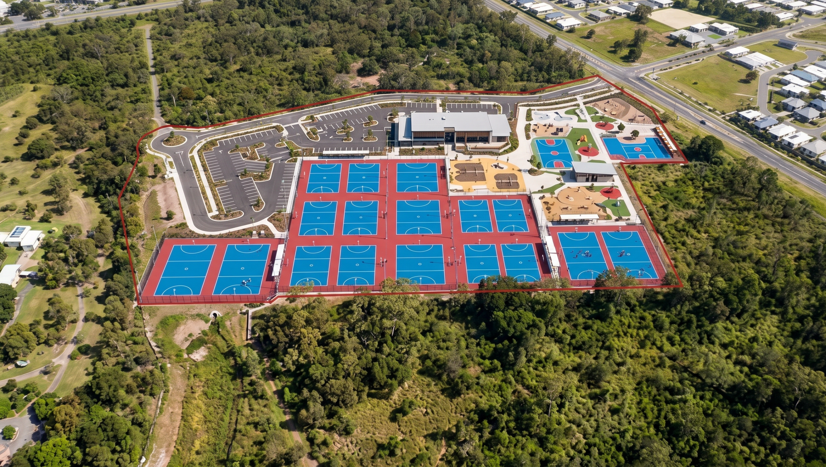
- 16 netball courts in the central precinct.
- Clubhouse building at the northern end of the courts.
- Public amenities building only in the location shown.
- Youth precinct only in the location shown.
- Car parks only in the areas shown on the overlay.
- Internal roads only in the areas shown on the overlay.
- Pathways only in the areas shown on the overlay.
- Landscape treatment only within the overlay footprint.

EXISTING VEGETATION TO REMAIN:

All vegetation south of the main sports precinct.

All vegetation east of the main sports precinct.

All vegetation within the stormwater corridor.

All surrounding bushland.

No development is permitted outside the overlay areas.

SOUTHERN STORMWATER CORRIDOR:

The long irregular area extending south from the development footprint is a drainage reserve.

Leave this area as existing native vegetation.

No buildings.

No courts.

No roads.

No parking.

No pathways.

No playgrounds.

No facilities.

Retain natural bushland appearance.

SOUTH-EAST CORNER:

Leave as existing trees and vegetation.

No sports courts.

No buildings.

No recreational facilities.

No hardstand.

No parking.

Do not develop this area.

RENDER STYLE:

Photorealistic aerial drone view.

Match the aerial photograph perspective exactly.

Maintain existing roads.

Maintain existing residential development.

Maintain existing topography.

High quality architectural rendering.

Realistic Queensland native landscape.

Realistic materials.

Do not alter the site layout.

NO additional courts.

NO additional buildings.

NO additional sports facilities.

NO development outside overlay graphics.

NO pathways outside overlay graphics.

NO playgrounds outside overlay graphics.

NO amenities outside overlay graphics.

NO hardstand outside overlay graphics.

NO parking outside overlay graphics.

NO structures in bushland.

NO structures in drainage corridor.

NO structures in south-east corner.

NO design interpretation.

NO master planning.

NO additional landscaping features.

NO expansion of the site.

NO invented architecture.

NO water features.

NO pavilions.

NO shade structures.

NO recreation courts.

NO sports fields.

NO modifications to undeveloped areas.

ADDITIONAL DESIGN CORRECTIONS:

Netball Courts:
- Change all netball courts to match the architect reference images.
- Use blue playing surfaces with red perimeter zones and red court surrounds.
- Match the colour scheme, material finish and visual appearance of the uploaded reference renders.
- Maintain professional competition-standard netball court finishes.

Northern Car Park:
- Remove the building located within the northern car parking area.
- This location is car parking only.
- Replace the building footprint with landscaped parking bays, drive aisles and circulation areas consistent with the site plan.
- No structures are permitted within this car park area.

STRICT SITE ACCURACY:
- Buildings are only permitted in locations shown on the architectural overlay.
- Do not create additional buildings within parking areas.
- Do not create maintenance buildings, storage buildings, pavilions, kiosks or amenities unless explicitly shown on the site plan.

Create renders like this

Turn any photo, sketch, or floor plan into a photoreal render in seconds.