Skip to content
Render tools
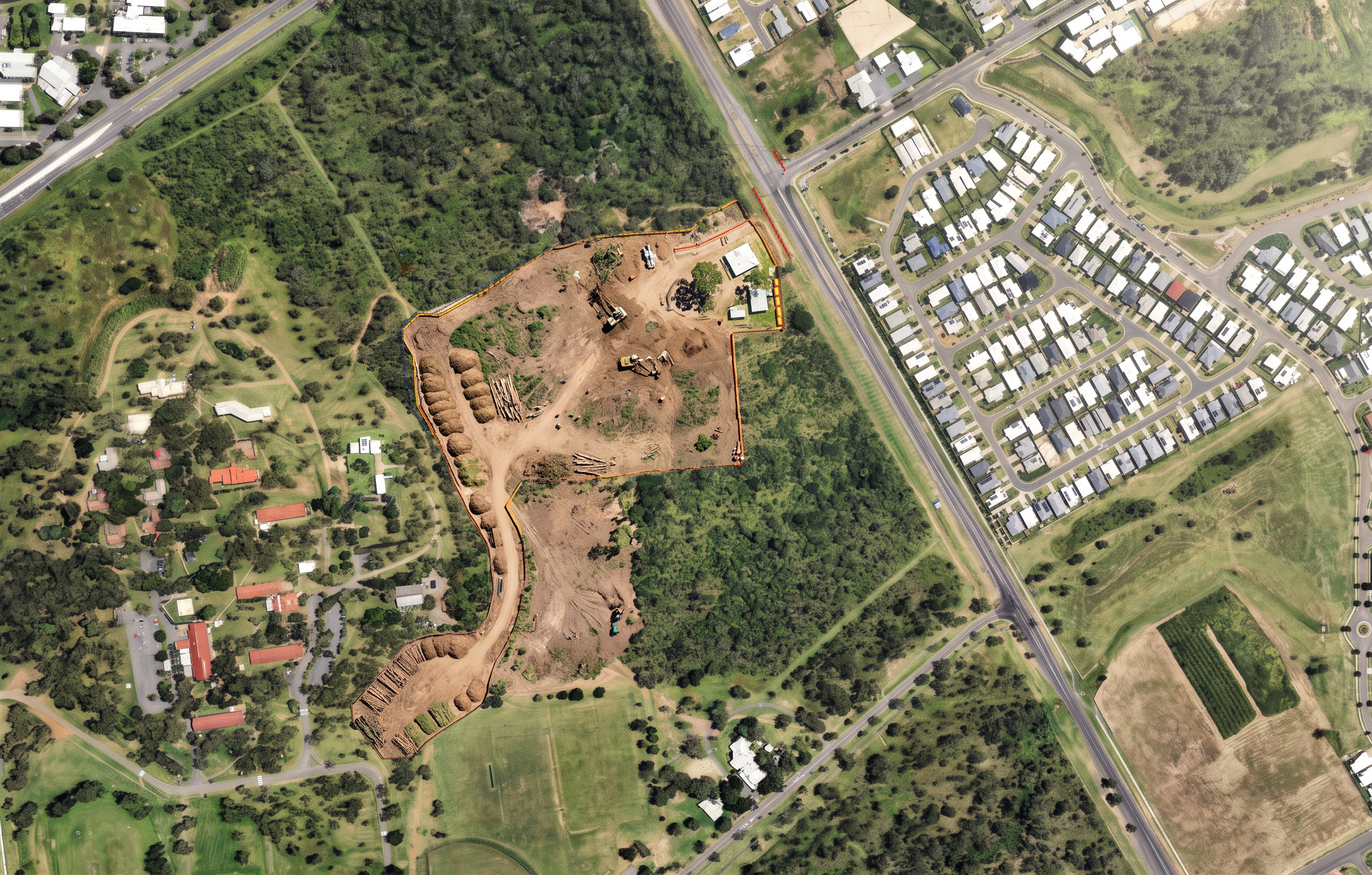
Create a photorealistic aerial visualisation showing Stage 1B Vegetation Clearing for the Rockhampton Sports Precinct.

CRITICAL INSTRUCTION

The supplied Overall Site image is the master image.

This is NOT a design exercise.

This is NOT a masterplanning exercise.

This is NOT an earthworks visualisation.

This is an image-to-image transformation of the supplied aerial photograph.

Maintain the exact:

- site footprint
- site geometry
- site boundaries
- camera angle
- camera height
- image extent
- aerial perspective
- orientation
- scale

The final image should appear as though the same aerial photograph has been taken during vegetation clearing works.

SITE BOUNDARY REQUIREMENTS

The brown soil area shown on the supplied Overall Site image defines the EXACT construction footprint.

Treat the brown soil area as a HARD MASK.

The brown footprint must remain identical in:
- shape
- length
- width
- alignment
- boundary location

Do not alter the footprint.

Do not widen any area.

Do not create any new disturbed areas.

Do not disturb vegetation outside the brown footprint.

Everything outside the brown footprint must remain exactly as existing vegetation.

TREE CLEARING WORKS ONLY

This image represents vegetation clearing only.

Bulk earthworks have not commenced.

Civil works have not commenced.

Platform formation has not commenced.

Court construction has not commenced.

Building construction has not commenced.

Show:

- selective tree clearing
- recently cleared vegetation
- excavators with tree-grab attachments
- forestry mulchers
- chainsaw crews
- grubbing operations
- stump removal
- mulch stockpiles
- timber stockpiles
- temporary access routes
- environmental controls
- exclusion fencing
- sediment fencing

CLEARING SEQUENCE

Show clearing progressing generally from the southern drainage corridor toward the northern development area.

Southern corridor should appear most advanced.

Northern footprint should show active clearing operations underway.

GROUND CONDITIONS

Inside footprint:
- exposed natural topsoil
- cleared vegetation
- timber stockpiles
- mulch piles
- tree stumps
- minimal disturbance

Outside footprint:
- unchanged vegetation
- unchanged roads
- unchanged residential areas
- unchanged open space

VISUAL STYLE

Photorealistic drone photography.

Queensland bushland setting.

Professional tender methodology visual.

Construction progress image.

Natural colours.

High realism.

Site accuracy is more important than visual effects.

FOOTPRINT ACCURACY IS THE HIGHEST PRIORITY.

NO bulk earthworks.

NO large dirt stockpiles.

NO engineered fill mounds.

NO haul roads.

NO cut and fill operations.

NO site grading.

NO building pads.

NO court platforms.

NO sediment basin excavation.

NO swales.

NO drainage works.

NO underground services.

NO netball courts.

NO clubhouse.

NO amenities building.

NO youth precinct.

NO carparks.

NO roads under construction.

NO construction outside the brown footprint.

NO change to footprint geometry.

NO change to boundary alignment.

NO widening of corridor.

NO redesign of site.

NO altered camera angle.

NO altered site layout.

USE BROWN FOOTPRINT AS A HARD MASK.

Preserve the brown construction footprint exactly as drawn. Only replace vegetation within this footprint with tree clearing activities. Do not create any new disturbed ground.

Create renders like this

Turn any photo, sketch, or floor plan into a photoreal render in seconds.