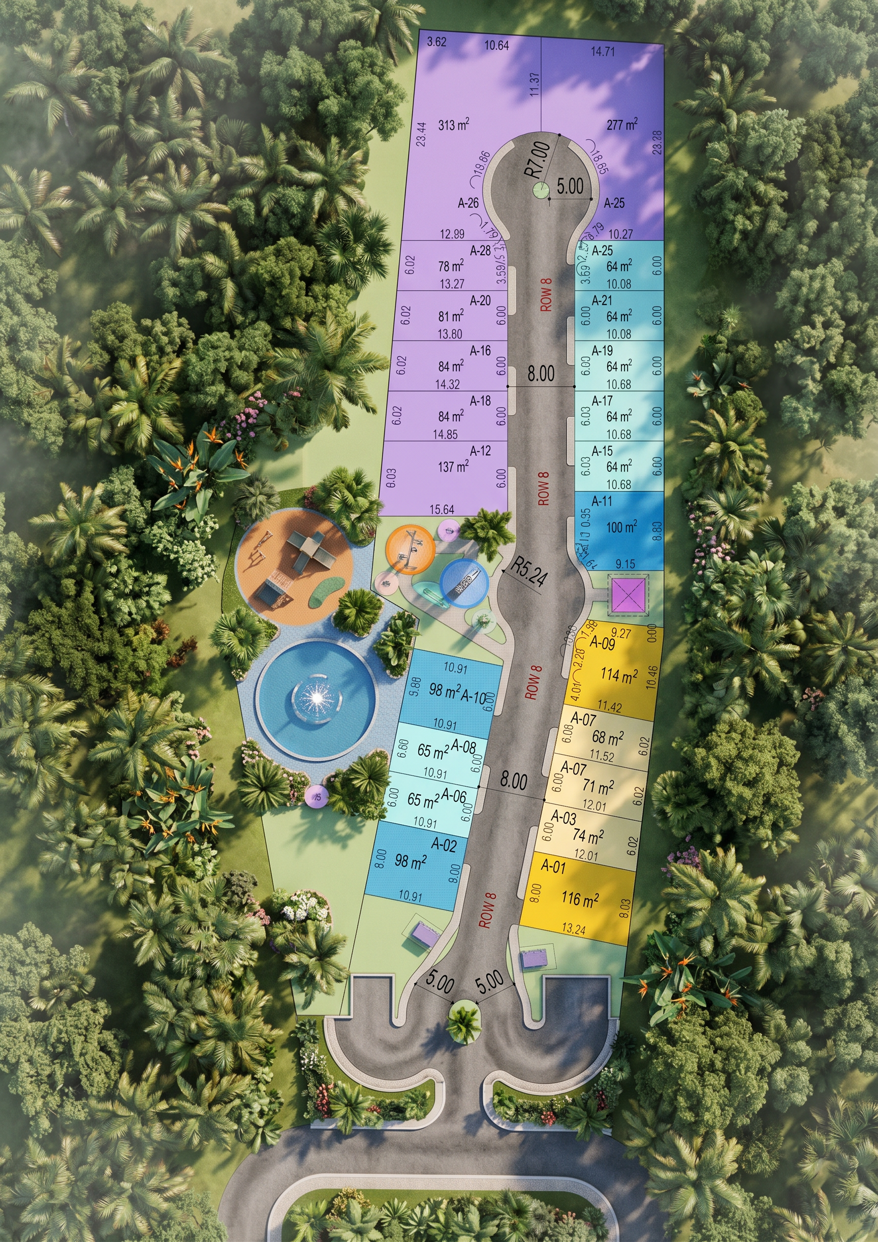
- Prompt
- Create a highly realistic architectural rendering that preserves the exact structure, geometry, proportions, camera angle, composition, labels, colors, and material placement of the original image. Retain the irregular, elongated site boundaries, main road (ROW), precise lot subdivisions, dimensions, vehicle turning circles, access points, communal landscape areas, playground elements, trees, color-coded lot zones, boundary lines, and all visible site geometry without altering the design or omitting any elements. Add limited surrounding context only where currently absent: realistic atmospheric haze, neighboring land depicted merely as clusters of trees, minimal streetscape elements, and atmospheric depth, all without obscuring the main site area. Employ high-end architectural rendering quality (V-Ray or Corona) featuring physically accurate natural lighting, global illumination, HDR reflections, soft natural shadows, contact occlusion, realistic terrain textures, subtle material roughness details, crisp edges, and authentic aerial perspective. Include convincing vegetation and public area finishes only in pre-designated locations. Do not add new buildings, roads, lots, furniture, vehicles, people, signage, or architectural elements; avoid flat diagrammatic looks, sketches, raw viewport views, plastic-looking CGI, or artificial graphics.
Render the image as a high-end, photorealistic aerial master plan visualization showcasing architecture, roads, public areas, landscaping, water features, natural lighting, atmospheric depth, and physically realistic shadows.
Develop the master plan with a tropical atmosphere and landscape; the site is surrounded by trees.
- Created
- August 10, 2026