Skip to content
Render tools
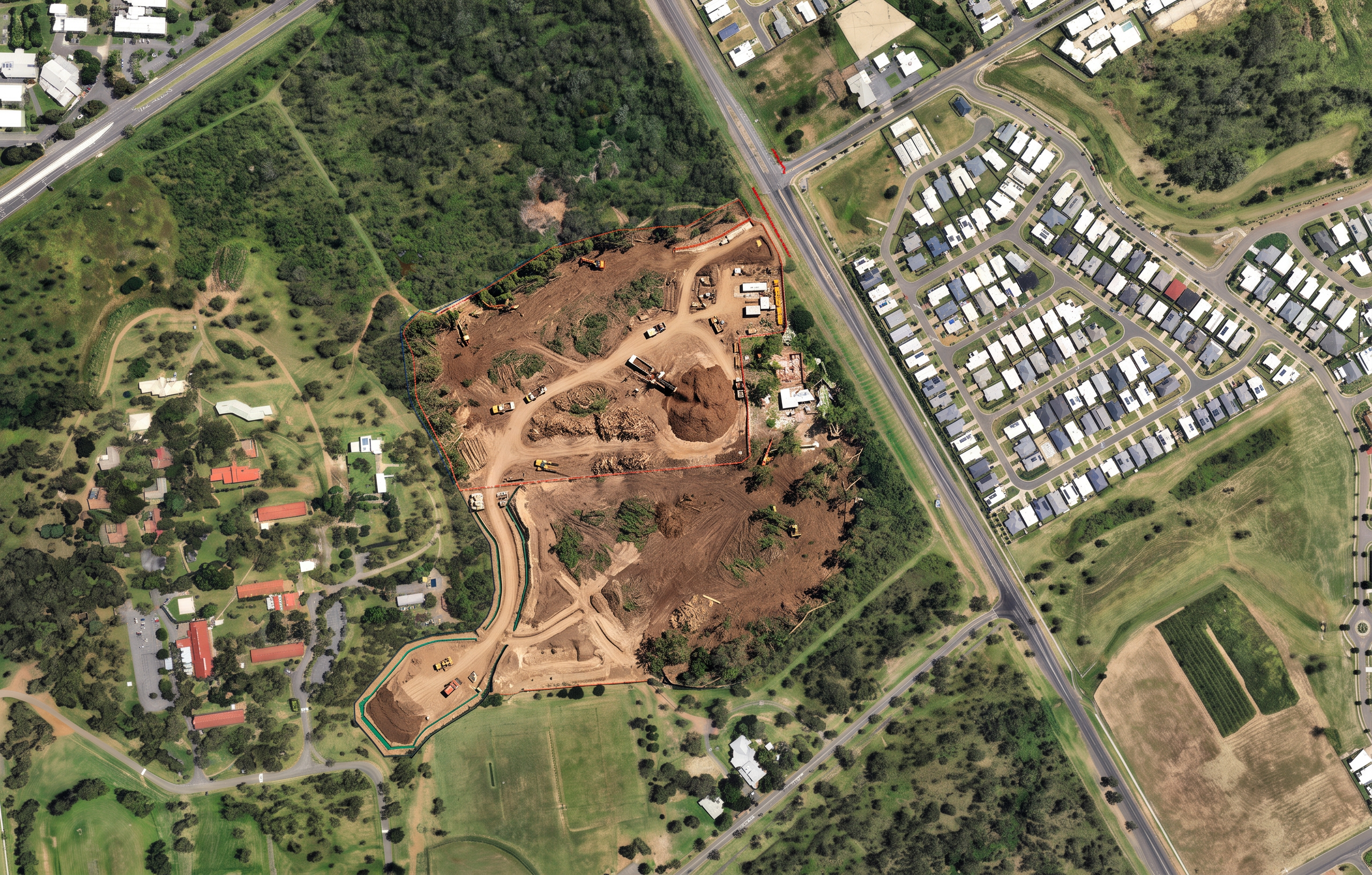
Transform the supplied Overall Site image into a photorealistic tree clearing construction visualisation.

CRITICAL INSTRUCTION:

The supplied Overall Site image is the master reference.

Maintain the EXACT site geometry, footprint, boundaries, orientation, scale and camera position.

This is an image enhancement exercise only.

Do not redesign the site.

Do not reinterpret the footprint.

Do not create new clearing patterns.

Do not change the shape of any cleared area.

The brown shaded areas shown on the Overall Site image represent the approved construction clearing footprint.

Treat the brown footprint as a fixed construction boundary.

Only modify the brown shaded areas.

Everything outside the brown footprint must remain unchanged.

CAMERA REQUIREMENTS:

Maintain the exact aerial viewpoint shown on the supplied image.

Maintain the same:
- camera height
- camera angle
- orientation
- zoom level
- site coverage

Do not crop the image.

Do not zoom.

Do not rotate.

Do not alter perspective.

The final image should appear as if the same aerial photograph was taken during active vegetation clearing operations.

CLEARING WORKS:

Show vegetation clearing occurring only within the brown footprint.

Show clearing progressing generally from south to north across the site.

The southern drainage corridor should appear most advanced.

The northern development area should show active clearing operations underway.

Within the clearing footprint show:

- Exposed earth.
- Recently cleared vegetation.
- Stump removal.
- Mulched vegetation.
- Timber stockpiles.
- Mulching operations.
- Excavators with forestry attachments.
- Small dozers.
- Tipper trucks.
- Temporary access tracks.
- Sediment fencing.
- Construction exclusion fencing.

DEMOLITION:

Show limited demolition activity only within approved work zones.

Include:
- building demolition
- foundation removal
- service disconnections

GROUND CONDITIONS:

Inside footprint:
- cleared vegetation
- exposed natural earth
- mulch stockpiles
- construction tracks

Outside footprint:
- existing vegetation unchanged
- existing bushland unchanged
- existing roads unchanged
- existing residential development unchanged

VISUAL STYLE:

Photorealistic drone photography.
Construction progress image.
Major infrastructure project.
Queensland landscape.
Professional government tender presentation.
Ultra realistic.
High detail.
Natural lighting.

DO NOT alter the site footprint.

DO NOT modify the brown highlighted footprint shape.

DO NOT expand the clearing area.

DO NOT reduce the clearing area.

DO NOT create random clearing patterns.

DO NOT move the drainage corridor.

DO NOT alter the width of the drainage corridor.

DO NOT add roads.

DO NOT add carparks.

DO NOT add netball courts.

DO NOT add buildings.

DO NOT add the clubhouse.

DO NOT add amenities buildings.

DO NOT add youth precinct structures.

DO NOT create future construction stages.

DO NOT change surrounding vegetation.

DO NOT change neighbouring properties.

DO NOT change roads.

DO NOT change residential areas.

DO NOT rotate the image.

DO NOT crop the image.

DO NOT zoom the image.

DO NOT change the camera angle.

DO NOT create concept art.

DO NOT redesign the project.

Preserve all geometry exactly as shown in the supplied image.

Drawing accuracy is more important than visual realism.
Site geometry must be preserved exactly as shown in the supplied image.

Create renders like this

Turn any photo, sketch, or floor plan into a photoreal render in seconds.