Skip to content
Render tools
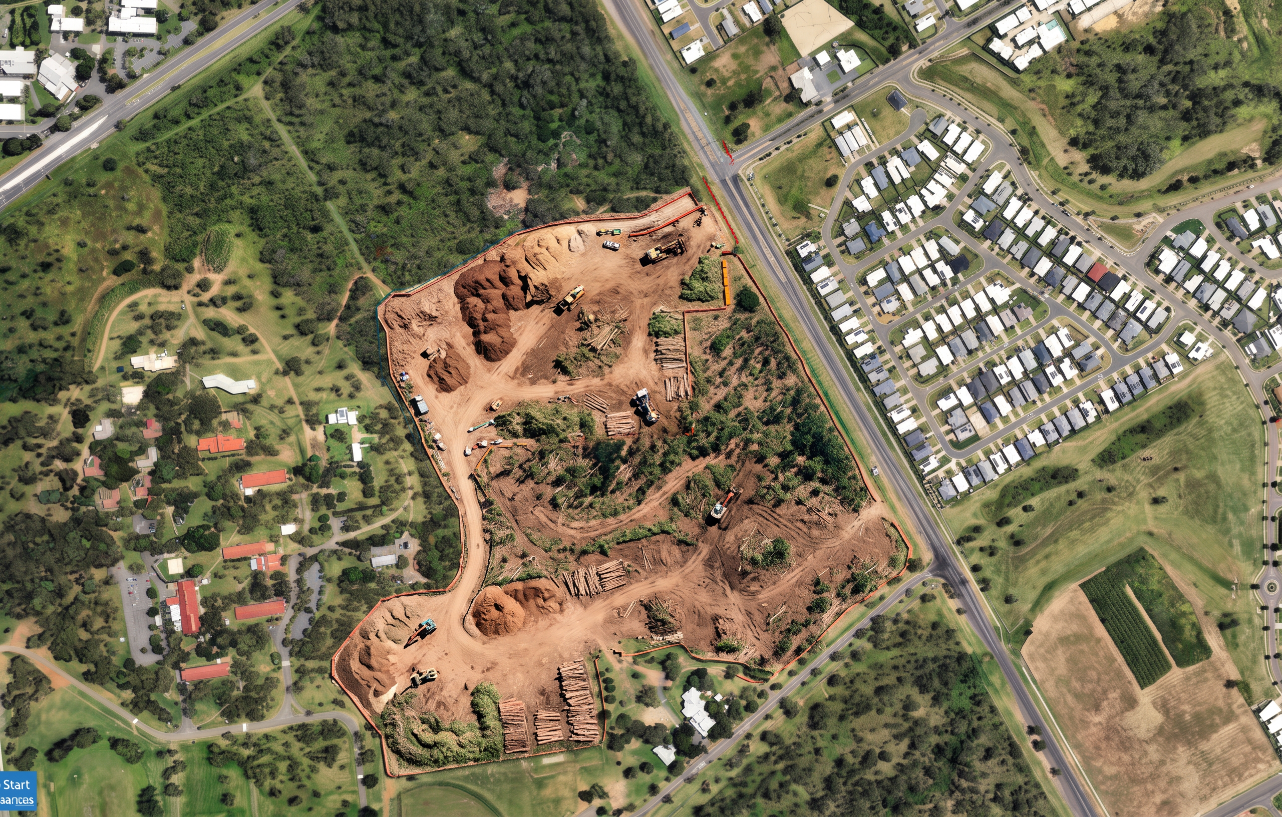
Create a photorealistic aerial construction visualisation for Rockhampton Sports Precinct – Stage 1B Vegetation Clearing.

CRITICAL INSTRUCTION

Use the supplied Overall Site image as the master reference.

The brown soil footprint shown on the original image defines the EXACT approved construction boundary.

Treat the brown footprint as a hard construction boundary.

Do not modify the shape.

Do not widen the boundary.

Do not create new disturbed areas.

Do not alter the geometry of the construction footprint.

All works must occur entirely within the existing brown footprint.

Everything outside the brown footprint must remain unchanged.

Maintain the exact:
- camera angle
- aerial viewpoint
- orientation
- image extent
- site coverage
- scale

This image must appear as the same aerial photograph with tree clearing activities added.

STAGE DESCRIPTION

This image represents vegetation clearing only.

The project has not commenced bulk earthworks.

The project has not commenced civil works.

The project has not commenced platform formation.

The project has not commenced netball court construction.

The project has not commenced building construction.

VEGETATION CLEARING ACTIVITIES

Show active tree clearing occurring inside the brown footprint only.

Show:
- selective tree removal
- vegetation clearing crews
- excavators with tree grabs
- forestry mulchers
- chainsaw crews
- stump removal
- grubbing operations
- mulch stockpiles
- timber stockpiles
- green waste stockpiles
- temporary access tracks
- sediment fencing
- exclusion fencing

CLEARING PROGRESSION

Show clearing progressively moving from the southern end of the site toward the northern development area.

The southern drainage corridor should appear most advanced.

The central corridor should be partially cleared.

The northern development area should show active clearing underway.

GROUND CONDITIONS

Inside the footprint:
- recently cleared vegetation
- exposed natural topsoil
- mulch piles
- timber stockpiles
- tree stumps
- cleared access tracks

Outside the footprint:
- existing vegetation unchanged
- existing roads unchanged
- existing residential areas unchanged
- existing bushland unchanged

VISUAL STYLE

Photorealistic drone image.
Queensland bushland setting.
Government infrastructure project.
Construction methodology visualisation.
Professional tender presentation quality.
Natural lighting.
High realism.
NO bulk earthworks.

NO cut and fill operations.

NO earthmoving batters.

NO engineered stockpiles.

NO imported fill.

NO large mounds of soil.

NO graded building platforms.

NO court platforms.

NO sediment basin excavation.

NO drainage excavation.

NO swales.

NO roads under construction.

NO netball courts.

NO clubhouse.

NO amenities buildings.

NO youth precinct structures.

NO concrete works.

NO asphalt works.

NO construction outside the brown footprint.

NO site redesign.

NO altered boundaries.

Site clearing only.

This image should look like a recently cleared bushland site immediately before bulk earthworks commence.

Create renders like this

Turn any photo, sketch, or floor plan into a photoreal render in seconds.