Skip to content
Render tools
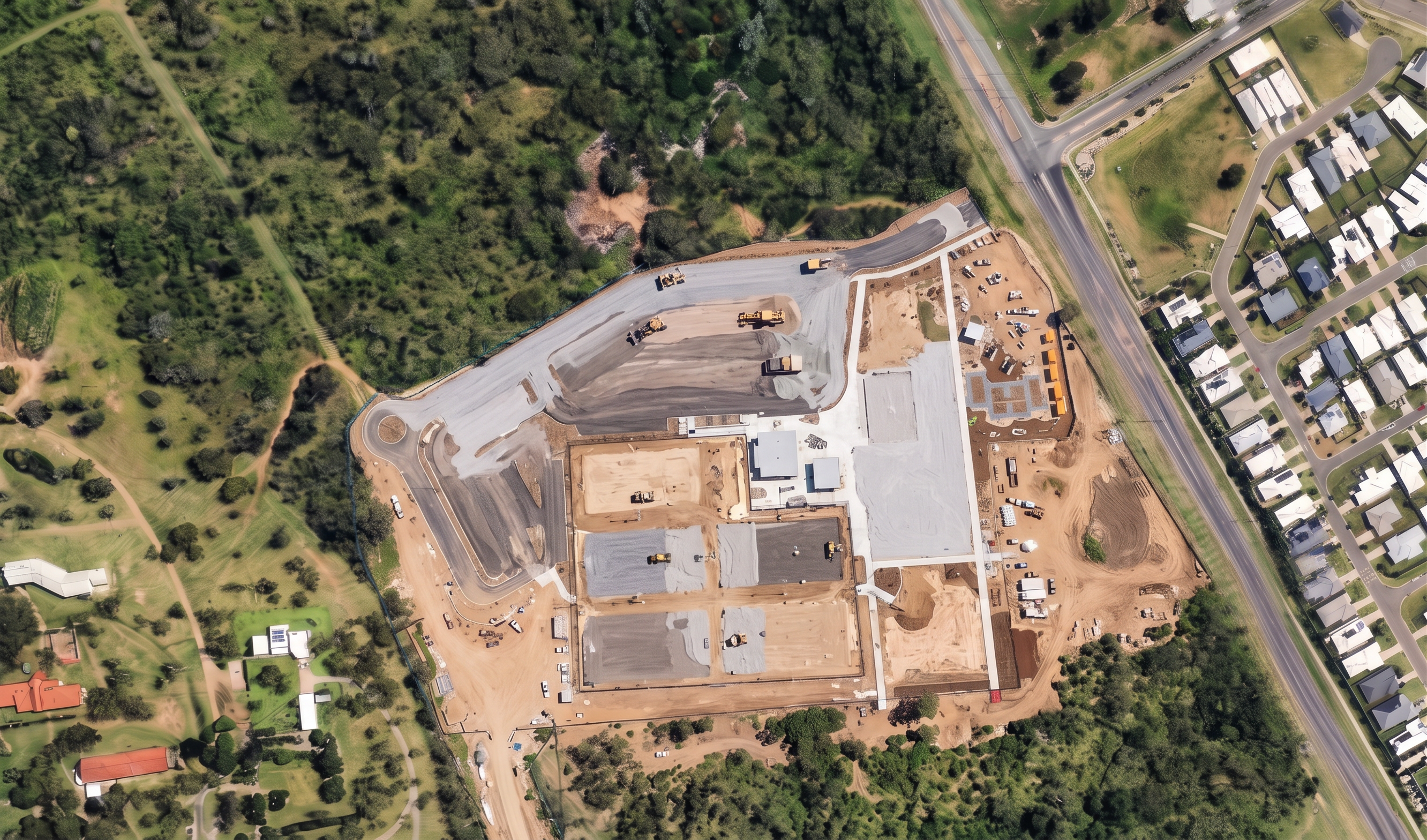
Create a photorealistic aerial construction visualisation for Rockhampton Sports Precinct – Stage 4 Netball Court Construction.

CRITICAL INSTRUCTION

Use the supplied overlay image as the master reference.

The overlay controls all geometry.

Maintain the EXACT:

- camera angle
- aerial viewpoint
- orientation
- image extent
- site boundary
- court locations
- carpark locations
- building locations

Do not redesign the site.

Do not move any courts.

Do not add any courts.

Do not add any roads.

Do not add any parking areas.

Do not add any buildings.

The final image must appear as the same aerial drone photograph taken during active court construction.

BIRD'S-EYE VIEW

Use a near vertical aerial drone view.

The entire site footprint must be visible.

Maintain the same viewpoint as previous storyboard images.

NETBALL COURT CONSTRUCTION

The red court outlines indicate the exact netball court locations.

Use these only as geometry reference.

Remove the red graphics.

Replace the court areas with active construction works.

Show:

- Clearly defined rectangular court footprints.
- Court earthworks completed.
- Excavated court formation areas.
- Court foundations actively under construction.
- Stabilised subgrade being installed.
- Crushed rock sub-base placement underway.
- Basecourse installation underway.
- Root barrier installation.
- Trench drain installation.
- Survey pegs and level checks.
- Civil construction crews.
- Excavators undertaking minor works.
- Rollers compacting court areas.
- Water carts controlling dust.

Construction should occur across all courts simultaneously.

Some courts should look more advanced than others.

The court areas should remain visibly under construction.

Do not create completed pavement areas.

Do not create finished court surfaces.

Do not create blue or red courts.

Do not create line marking.

Do not create fencing.

Do not create sports lighting.

Do not create goal posts.

CARPARK CONSTRUCTION

The grey carpark footprint defines the exact future carpark area.

Show:

- Gravel placement underway.
- Crushed rock pavement spreading.
- Basecourse installation.
- Pavement compaction.
- Road rollers compacting gravel.
- Surveyors checking levels.
- Pavement trimming and preparation.

The carpark should appear approximately 60–70% complete.

Do not show asphalt.

Do not show line marking.

Do not show completed parking bays.

BUILDINGS

The light grey building footprints are geometry references only.

Show:

- Prepared building platforms.
- Minor footing excavation if visible.

Do not show structural steel.

Do not show roofing.

Do not show completed buildings.

Do not enlarge any building footprint.

SITE CONDITION

Bulk earthworks complete.

Civil services substantially complete.

Court construction actively underway.

The site should clearly represent the stage immediately before asphalt paving and acrylic court surfacing commence.

VISUAL STYLE

Photorealistic aerial drone photography.

Professional government tender visualisation.

Major sports infrastructure project.

Queensland construction environment.

Natural lighting.

High realism.

Construction methodology storyboard image.

Overlay accuracy is more important than artistic realism.

NO blue courts.

NO red courts.

NO acrylic surfacing.

NO court line marking.

NO goal posts.

NO fencing.

NO sports lighting.

NO completed court slabs.

NO uniform grey court slabs.

NO asphalt.

NO completed carparks.

NO additional courts.

NO additional roads.

NO additional parking.

NO additional buildings.

NO enlarged buildings.

NO clubhouse structure.

NO amenities structure.

NO landscaping.

NO turf.

NO playgrounds.

NO youth precinct.

NO site redesign.

NO geometry changes.

NO movement of court locations.

NO movement of carpark areas.

Overlay controls all geometry.


Create renders like this

Turn any photo, sketch, or floor plan into a photoreal render in seconds.