- Prompt
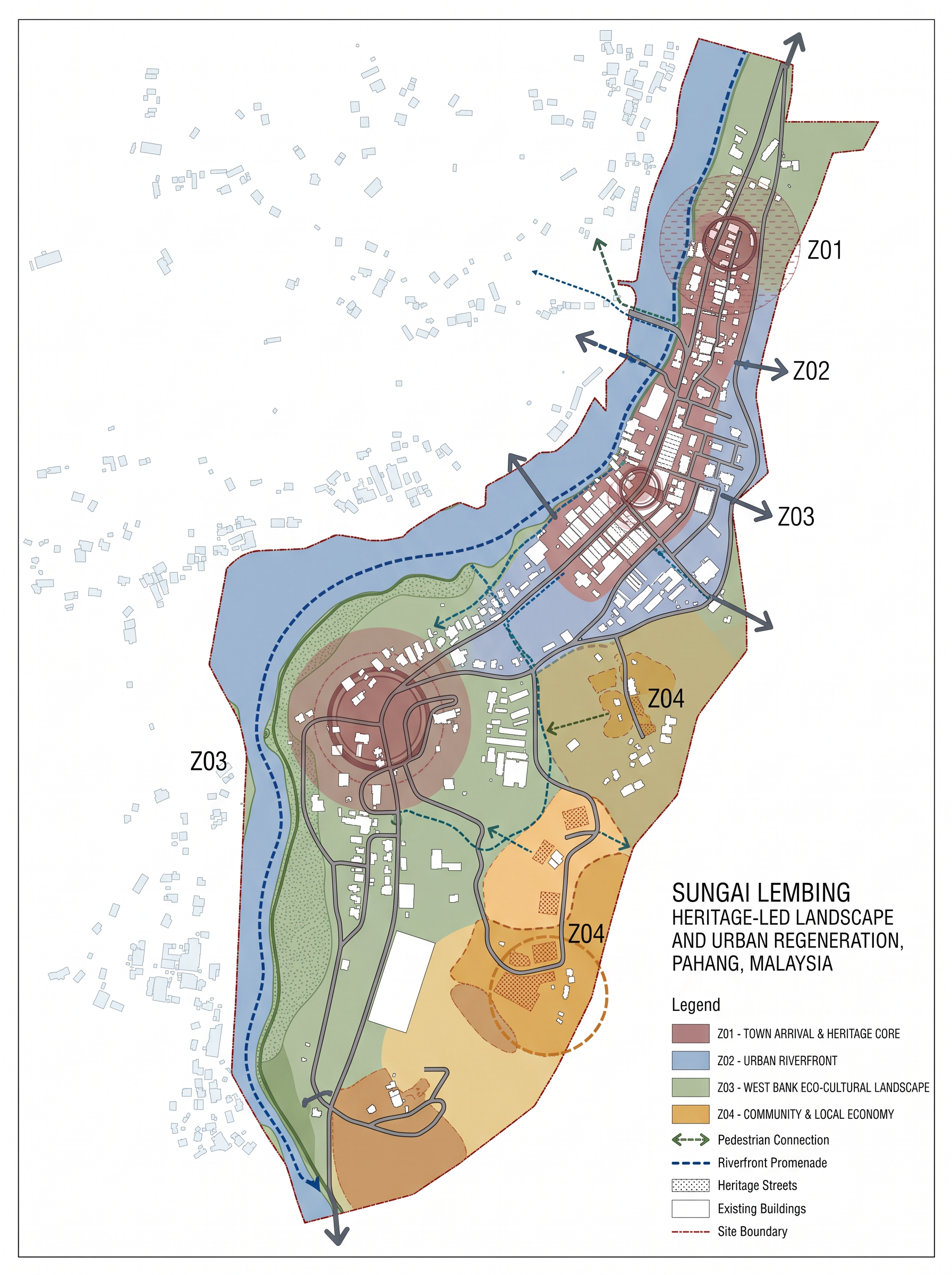
- Create a PROFESSIONAL 2D CONCEPTUAL MASTERPLAN for Sungai Lembing Heritage-Led Landscape and Urban Regeneration, Pahang, Malaysia.
IMPORTANT: This is a flat 2D concept plan, NOT a render, 3D view, aerial photograph or watercolor illustration.
1. PRESERVE THE ORIGINAL BASE MAP
Treat the uploaded Sungai Lembing base map as the spatial source of truth. Preserve all existing building footprints, building positions, road alignments, road widths, junctions, bridges, river geometry, property boundaries, settlement patterns and site boundaries exactly as shown. Do not move, add, delete, resize, rotate, straighten or invent any existing features. If information is unclear, preserve the original geometry.
2. CONCEPT PLAN GRAPHICS
Use a true top-down orthographic view. Create precise CAD-style polylines, connected polygons, clean boundaries and flat colour fills. Clearly differentiate existing buildings and roads from proposed interventions. Represent landscape areas, public spaces, pedestrian routes, riverfront spaces, heritage areas, ecological corridors and activity nodes using controlled, readable symbols and defined spatial shapes. Avoid random geometry and large vague colour blobs.
3. FOUR DESIGN ZONES
Z01 — TOWN ARRIVAL & HERITAGE CORE: heritage streets, arrival spaces, civic areas and pedestrian connections.
Z02 — URBAN RIVERFRONT: riverside public spaces, promenades, activity nodes and river-edge landscape.
Z03 — WEST BANK ECO-CULTURAL LANDSCAPE: ecological areas, existing vegetation, low-impact trails and nature interpretation.
Z04 — COMMUNITY & LOCAL ECONOMY: community gathering spaces, local activity areas and market spaces where appropriate.
Follow the supplied zoning map or concept sketch for zone locations. Do not invent zone boundaries or place interventions arbitrarily.
4. GRAPHIC STYLE
Professional urban design competition plan, clean AutoCAD linework, Adobe Illustrator vector aesthetics and restrained Photoshop finishing. Pure white background, crisp connected lines, consistent line weights and controlled muted colours: burgundy, terracotta, sage green, olive green, muted blue and light grey. Keep the composition clear, polished and legible.
5. REFERENCE IMAGES
Use the base map for spatial geometry. Use reference images only for graphic style, colour palette and diagram presentation. Never copy their site layouts or override the original base map.
6. STRICTLY EXCLUDE
3D views, perspective, photorealistic rendering, isometric buildings, watercolor effects, dramatic shadows, textured backgrounds, invented buildings, altered roads, modified river geometry, decorative scenery and unnecessary text or labels.
FINAL RESULT: A clean, flat 2D conceptual masterplan with clearly defined intervention polygons, colour-coded spaces, precise linework and professional planning graphics. Prioritise spatial accuracy over decoration. If geometry cannot be preserved, do not reconstruct or alter it; limit changes to visual styling.
- Created
- October 10, 2026
- Seed
- 1