Skip to content
Render tools
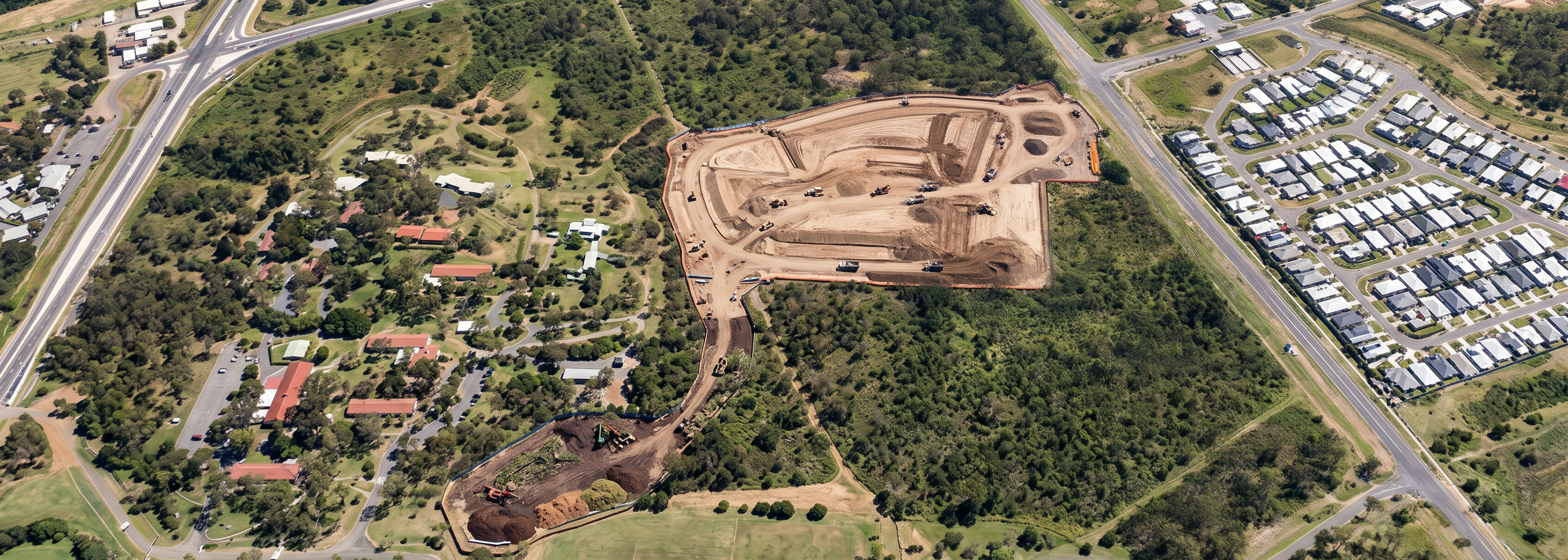
Create a photorealistic aerial construction progress visualisation for Rockhampton Sports Precinct.

IMPORTANT:

Use the supplied construction render as the reference image for camera position, viewing angle, zoom level, composition and perspective.

Maintain the exact same aerial drone viewpoint.

Do not rotate, crop or zoom into the site.

Match the reference image perspective as closely as possible.

The entire construction footprint including the southern drainage corridor must remain visible.

CONSTRUCTION STAGE DESCRIPTION:

The main northern development area has progressed beyond vegetation clearing and is now in the civil works and bulk earthworks phase.

The southern drainage corridor is at an earlier stage and is currently undergoing vegetation clearing.

Show both stages occurring simultaneously.

NORTHERN DEVELOPMENT AREA:

Show advanced civil and earthworks activities including:

- Bulk earthworks completed in large areas.
- Formation levels taking shape.
- Earthmoving operations underway.
- Cut and fill activities.
- Shaped building platforms.
- Future court areas roughly graded.
- Temporary haul roads.
- Stockpiles of earth and fill material.
- Excavators and dozers operating.
- Rollers compacting formation areas.
- Tipper trucks moving material.
- Stormwater infrastructure installation.
- Site benches and batter slopes.

The area should appear approximately 40-60% through civil and bulk earthworks operations.

SOUTHERN DRAINAGE CORRIDOR:

Show active tree clearing works only.

- Recently cleared vegetation.
- Exposed earth.
- Mulched vegetation piles.
- Tree clearing equipment.
- Excavator with grab attachment.
- Clearing crews working.
- No civil works.
- No bulk earthworks.
- No roads.
- No infrastructure.

This area remains in the vegetation clearing phase.

SURROUNDING ENVIRONMENT:

Retain all vegetation outside the approved construction footprint.

Retain surrounding residential development.

Retain surrounding road network.

Retain existing bushland outside work zones.

CONSTRUCTION REALISM:

Site fencing where appropriate.

Sediment control measures.

Construction access points.

Temporary construction tracks.

Realistic Queensland construction site.

Professional major project appearance.

VISUAL STYLE:

Photorealistic aerial drone image.

Construction sequencing visualisation.

Tender presentation quality.

High resolution.

Natural sunlight.

Sharp detail.

Realistic machinery and earthworks.

Maintain the exact perspective and coverage of the supplied reference render.

CAMERA LOCK:

Match the uploaded reference render exactly.

Same camera height.

Same camera angle.

Same field of view.

Same site coverage.

Same orientation.

Do not zoom in.

Do not crop the southern corridor.

Show the entire project footprint from edge to edge exactly as per the reference image.

The final image should appear as the next construction stage photographed from the same drone position.

NO completed netball courts.

NO completed buildings.

NO car parks.

NO finished roads.

NO completed infrastructure.

NO architectural structures.

NO landscaping.

NO additional clearing outside construction footprint.

NO development outside approved footprint.

NO change to camera angle.

NO zooming.

NO site cropping.

NO removal of surrounding vegetation outside work areas.


Create renders like this

Turn any photo, sketch, or floor plan into a photoreal render in seconds.