Skip to content
Render tools
Image Enhancement Task - No Geometry Changes Permitted

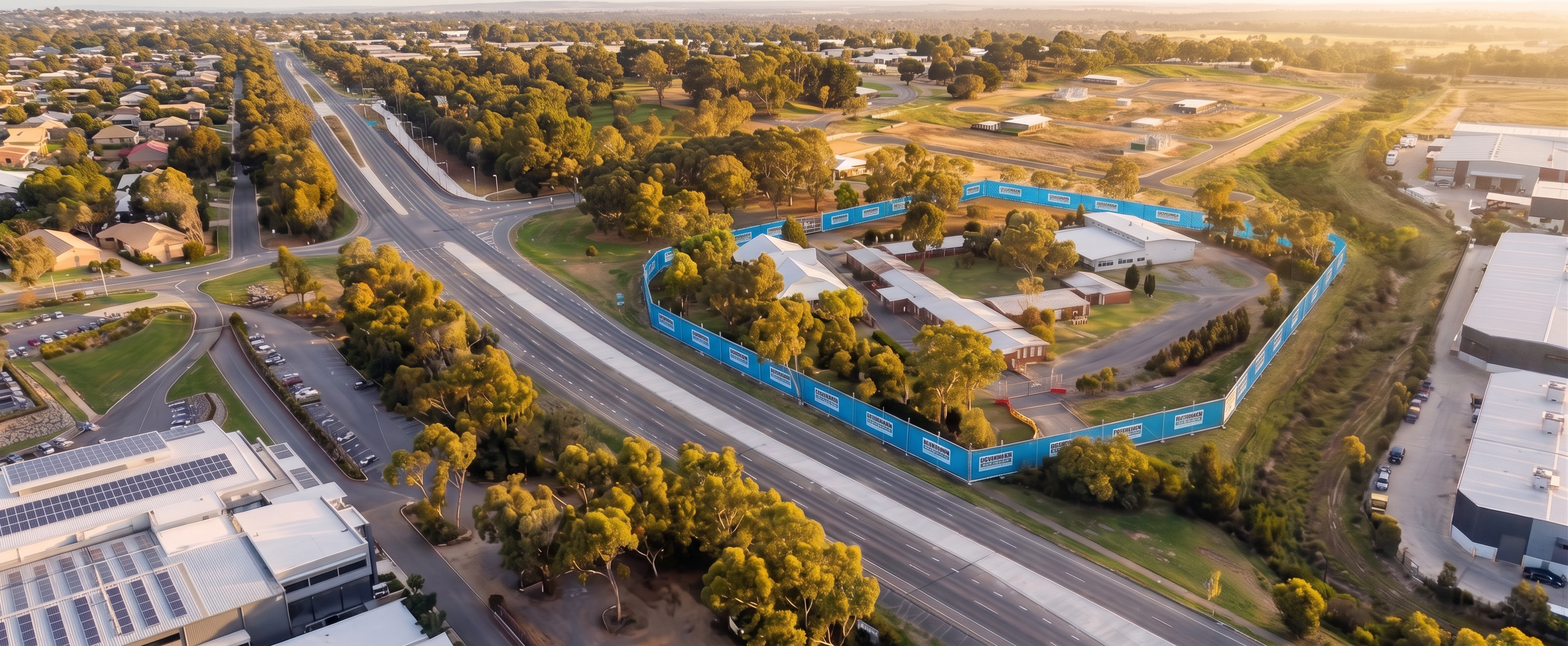
Using the supplied image as the sole source of truth, enhance the realism, sharpness, clarity and definition of the existing aerial image.

This is NOT a redesign, re-render, reconstruction or interpretation task.

Maintain exactly:

All existing buildings
Building footprints
Building heights
Building roof forms
Roads and intersections
Kerbs and pavements
Trees and vegetation locations
Site boundaries
Fencing locations
Terrain and contours
Drainage corridor
Carparks
Surrounding properties
Camera position
Camera height
Viewing angle
Perspective
Composition

The objective is to retain the image exactly as supplied while improving:

Image resolution
Surface detail
Texture quality
Foliage realism
Building material realism
Shadow definition
Overall sharpness
Colour balance
Contrast
Visual clarity

The final image should maintain the appearance of a high-quality Google Earth / Nearmap 3D aerial capture, not an architectural visualisation.

Buildings should remain the same shape and location but with clearer roof textures and better material definition.

Trees should remain in exactly the same locations and sizes but appear more realistic and better resolved.

Roads should remain unchanged but with sharper surface detail and markings.

Fencing should remain exactly as currently shown.

Do not introduce any artistic interpretation, redesign, smoothing, reshaping, remodelling or extrapolation of the site.

Do not add anything.

Do not remove anything.

Do not move anything.

Do not change any geometry.

Do not change any object size, shape or location.

The completed image should appear identical to the supplied image, with the only difference being increased realism, sharper detail, improved textures and higher-resolution visual quality.

Success Criteria: The image should look like the original aerial capture has been upgraded from low-resolution 3D mapping to high-resolution photorealistic 3D mapping while preserving 100% of the existing geometry and site conditions.

Create renders like this

Turn any photo, sketch, or floor plan into a photoreal render in seconds.