- Prompt
- Use Bird’s-eye / Aerial View with accurate plan readability, balanced exposure, a natural color scheme, and high-quality architectural documentation. Add a discreet atmospheric realism without altering the layout. Remodeling, relocation, additions, omissions, lettering, furniture other than visible seating, people, decorative objects, additional plants, or altered buildings are prohibited. Flat graphic styles, clay surfaces, sketchy appearances, plastic CG, or viewport artifacts are prohibited.
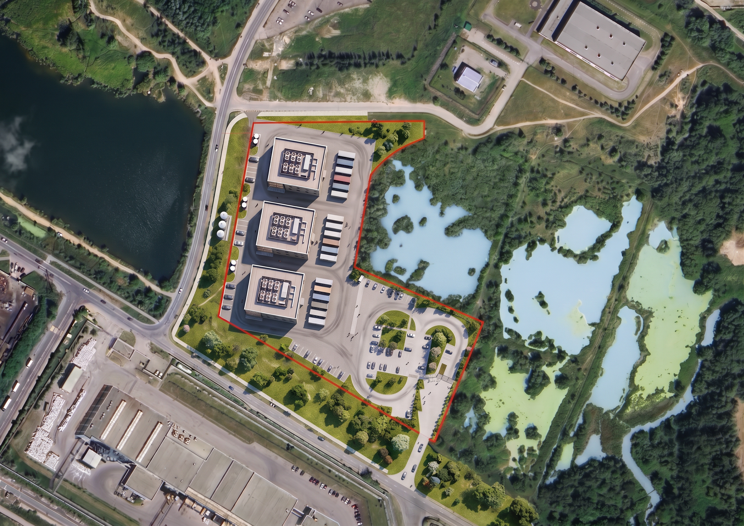
An ultra-realistic architectural photography project that preserves the exact geometry, proportions, boundaries, colors, and arrangement of site plan elements as in the original image.
This rendered, photorealistic architectural image of the site plan from start to finish preserves the jagged red boundary, three vertically arranged rectangular buildings, the asphalted area, parallel rows of containers, and repeating parking spaces with small fuel tanks along the left edge.
The greenery at the northern, southern, and western edges, surrounding roads, sidewalks, curved intersection, adjacent lots, and pale blue water or landscape context are preserved as shown in the image.
Preserve exact position, dimensions, distances and proportions of all the elements as shown in the image.
Only visual fidelity has been improved: subtle ripples and reflections on water surfaces, physically accurate pavement texture, subtle concrete joints, natural grass variations, realistic curbs and asphalt materials, sharp lot boundaries, realistic vehicle surfaces, contact shadows, ambient occlusion, global illumination, and soft daylight with a high dynamic range.
- Created
- August 17, 2026