Skip to content
Render tools
Treat the supplied aerial overlay as a site masterplan. The overlay geometry is fixed and must not be altered. Render the design exactly as shown and only enhance realism, materials, vegetation and lighting
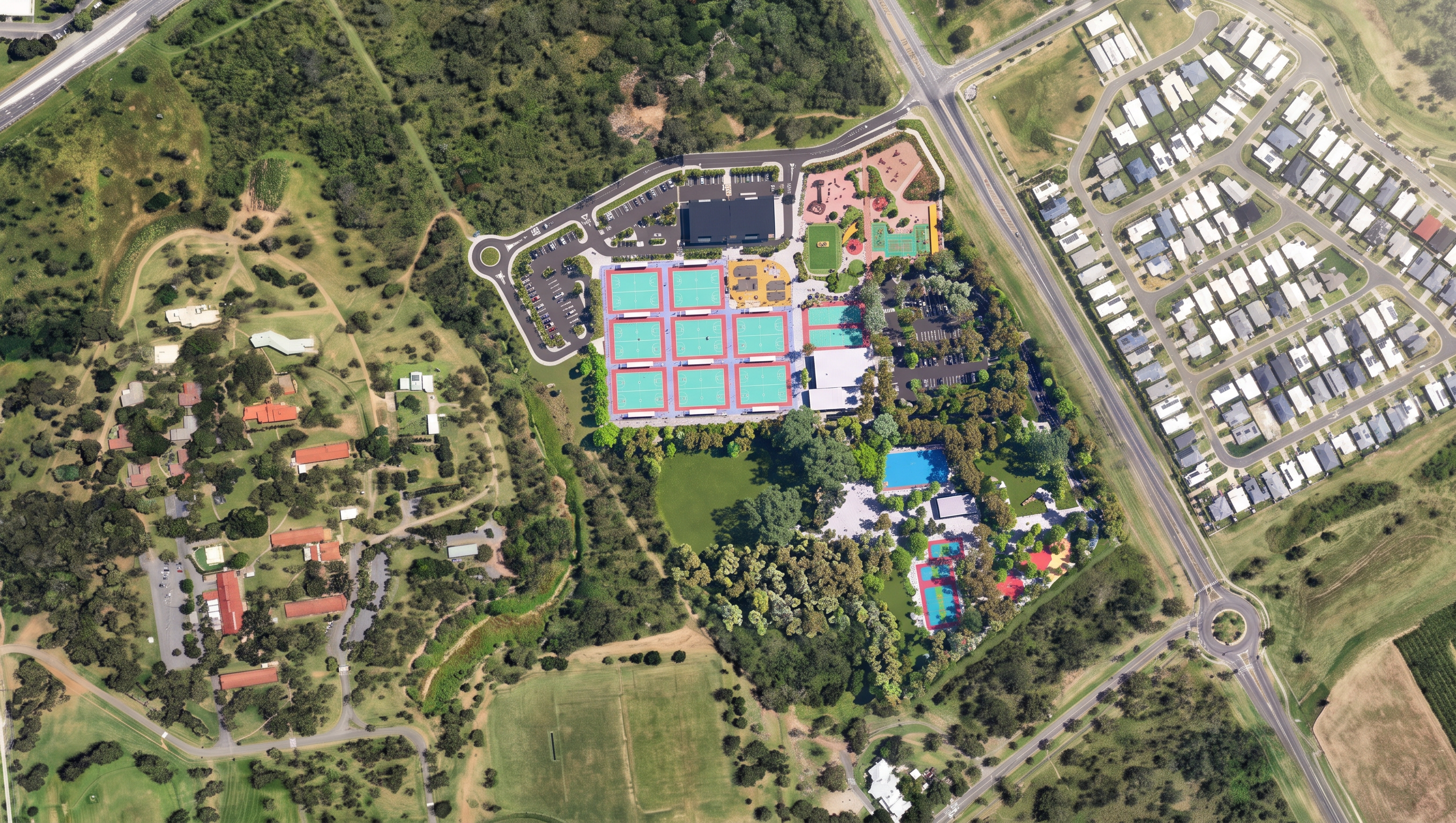
Create a completed photorealistic aerial render of the Rockhampton Sports Precinct Stage 1 Netball Centre.

PRIMARY INSTRUCTION:
Follow the supplied aerial overlay image exactly. The coloured development overlay defines all new works. Only construct items shown within the overlayed development footprint.

SITE ACCURACY IS MORE IMPORTANT THAN VISUAL INTERPRETATION.

Development to include:
- 16 netball courts as shown.
- Netball clubhouse in the exact location shown.
- Public amenities building in the exact location shown.
- Youth precinct and recreation courts in the exact locations shown.
- Car parks and internal roads only where shown on the overlay drawing.
- Landscape areas, pathways and plazas only where shown.

CRITICAL SITE BOUNDARY REQUIREMENTS:

The brown earthworks footprint shown on the aerial image defines the project extent.

The long narrow area extending south-west from the main development area is a stormwater drainage corridor.

DO NOT place:
- car parks
- roads
- buildings
- sports courts
- playgrounds
- public spaces
- hardstand areas
Do not modify the site footprint.
Do not convert drainage corridor into parking.
Do not place roads in drainage corridor.
Do not place buildings in drainage corridor.
Do not place courts in drainage corridor.
Do not extend development into bushland.
Do not add additional buildings.
Do not add additional sports fields.
Do not add additional courts.
Do not add lakes or water features.
Do not add grandstands.
Do not add large events or crowds.
Do not add structures not shown on the drawings.
Do not redesign the project.
Do not change the layout.
Do not change the scale.
Do not alter existing road network.
Do not alter surrounding residential development.
Do not replace existing bushland with development.

within this southern drainage corridor.

Retain the entire drainage corridor as natural open space with dense native vegetation, grasses, stormwater planting and existing bushland character.

The drainage corridor must appear undeveloped and blend naturally into the surrounding landscape.

SURROUNDING LANDSCAPE:

Retain all existing surrounding bushland outside the development footprint.

Retain the existing residential neighbourhood to the east.

Retain the existing road network, intersections and roundabouts.

Do not expand the development footprint beyond the overlay shown.

COURTS AND BUILDINGS:

Match the arrangement, quantity and orientation exactly as shown.

Do not invent extra courts.

Do not invent extra buildings.

Do not increase the size of any facility.

Use the architect reference renders for:
- court colours
- building materiality
- planting style
- landscaping quality
- lighting
- realism

VISUAL QUALITY:

Photorealistic architectural aerial rendering.
High-end competition submission quality.
Queensland subtropical landscape.
Mature native tree canopy.
Realistic materials.
Natural shadows.
Bright sunny day.
Realistic human activity.
Drone photograph appearance.
Ultra-high resolution.

Create renders like this

Turn any photo, sketch, or floor plan into a photoreal render in seconds.