Skip to content
Render tools
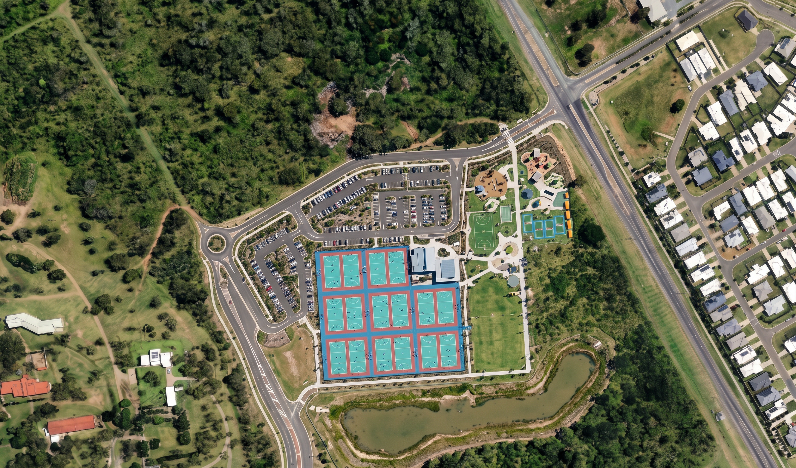
Create a photorealistic aerial render of the Rockhampton Sports Precinct Stage 1.

The uploaded site plan must be reproduced exactly. Treat the site plan as a traced reference rather than a design guide. Do not estimate, redesign, reinterpret, optimise or improve the layout.

All geometry must match the site plan on a one-to-one basis.

Preserve the exact aerial camera position and perspective from the existing aerial render.

Replicate the following exactly as shown on the site plan:

Netball court quantity, arrangement and dimensions.
Court spacing and orientation.
Court circulation areas.
Clubhouse location and footprint.
Road alignments.
Roundabout geometry.
Car park layouts and extents.
Internal pathways.
Playground and youth recreation area.
Pickleball courts.
Multisport courts.
Handball area.
Table tennis area.
Kickabout spaces.
Bus drop-off area.
Landscape areas.
Retained vegetation zones.
Drainage basin geometry.
Site boundaries.

The netball precinct must exactly match the site plan and not deviate in court numbers, proportions, spacing or alignment.

Apply the colours and materials from the architectural render reference image:

Netball courts to match the architectural render colour scheme.
Matching court surfacing colours and line marking style.
Matching hardscape appearance.
Matching landscape character and planting style.

Maintain realistic aerial photography quality with natural Queensland daylight, realistic materials, accurate shadows and professional presentation quality.

Critical Instructions

Do not alter the approved design.

Do not modify any geometry contained within the site plan.

Do not create alternative layouts.

Do not fill gaps with AI-generated design decisions.

Do not add, remove, relocate, resize or reinterpret any feature.

Where the site plan and AI assumptions differ, the site plan always takes precedence.

Every building, court, path, road, landscape zone and recreation area must align directly with the uploaded drawing.

Negative Prompt

Do not:

Add additional courts.
Remove courts.
Change court dimensions.
Reposition courts.
Change clubhouse size or location.
Add sports fields not shown on the plan.
Change road geometry.
Change car park layouts.
Alter pathways.
Alter drainage basin shape.
Invent landscaping.
Invent structures.
Simplify the drawing.
Optimise the layout.
Create a conceptual interpretation.
Create a masterplan variation.
Final Instruction

Trace and reproduce the uploaded site plan exactly. Deviation from the approved drawing is not permitted. The site plan is the geometry authority and must be followed without exception.

Create renders like this

Turn any photo, sketch, or floor plan into a photoreal render in seconds.