- Prompt
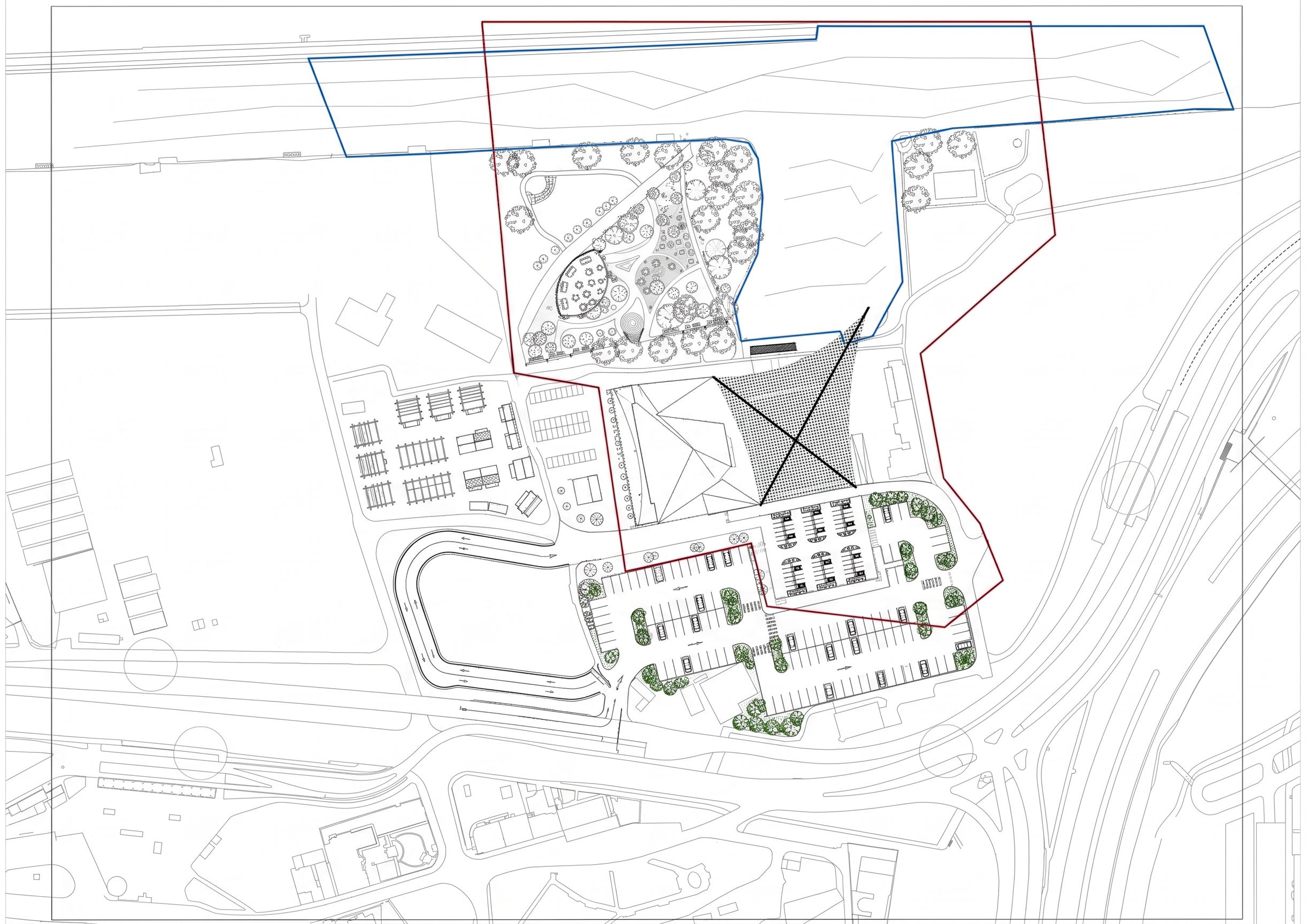
- Preserve the exact dimensions, geometry, proportions, and positions of all existing designed areas. Do not enlarge, shrink, rotate, relocate, or redesign any major spatial zones. Only improve the internal organization and detailing inside the marked boundaries while keeping the original footprint sizes exactly the same. Do not touch or modify the long linear river edge / water body shape at the top of the drawing. Keep the waterfront outline exactly as it is. Keep the park dimensions exactly the same as in the original drawing. Preserve the main building completely unchanged, including the roof geometry and the right pointed roof tip extending toward the water. Do not redesign the architecture. The outdoor summer market must remain on the open paved area directly to the left of the building. Redesign it only as a cleaner and more logical market layout using lightweight timber beam structures/pergolas, market stalls, and organized pedestrian circulation. Keep the exact size and location of the market area. Make it feel connected to the building entrance plaza and surrounding public space, but do not expand or relocate it. The riverside park in the upper-left area must keep its current size and boundaries exactly as drawn. Only improve the urban design quality inside it. Create a more refined and logical public park focused on staying near the water, relaxing, walking, and gathering. Improve pedestrian paths, seating logic, greenery placement, and connection to the waterfront promenade while preserving the overall dimensions and existing spatial footprint. The goal is not to redesign the park shape, but to make the movement, usability, and public space quality more realistic and architecturally resolved. The outdoor parking area below the building must also keep the exact same dimensions and position. Do not change its footprint size. Only reorganize the parking layout to feel more technically correct and urbanistically logical, including parking bays, driving aisles, pedestrian crossings, greenery islands, and realistic circulation. Maintain the existing vehicular access logic. The underground service ramp on the left side near the road should remain in the same location and function only as a service/loading access ramp. Refine its technical realism and circulation logic without moving it. Maintain all surrounding context, road layouts, water edges, and the architectural composition exactly as they are. Only improve functionality, pedestrian movement, urban design clarity, and public-space quality within the marked intervention zones. Render everything as a precise black-and-white AutoCAD-style site plan drawing with clean architectural linework only. No realistic rendering, no shadows, no colors, no textures, no atmospheric effects, dont change shape of anything else, keep exact camera angle
- Created
- May 24, 2026