Skip to content
Render tools
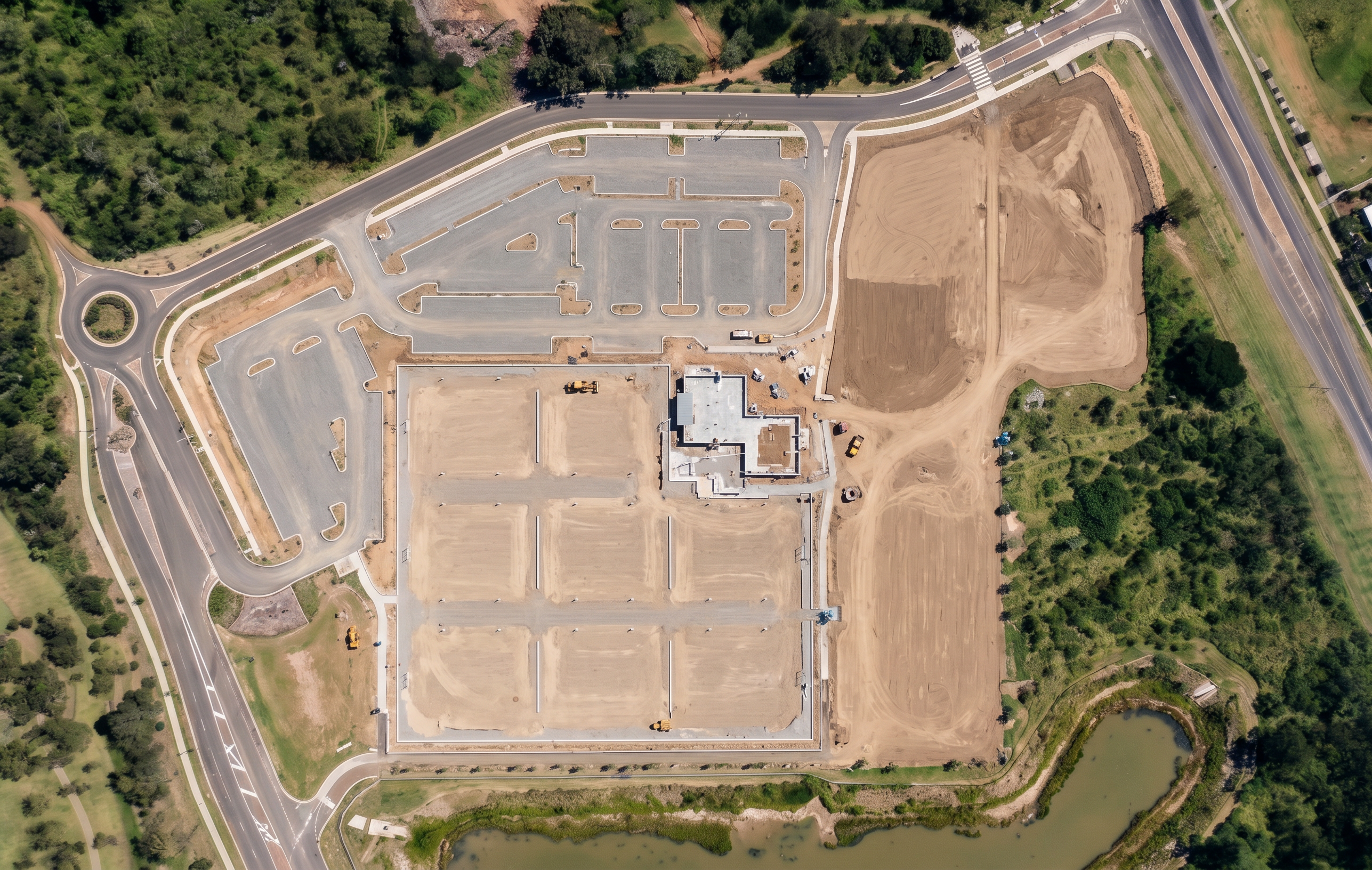
Create a photorealistic aerial construction progress render of the Rockhampton Sports Precinct during the netball court foundation and carpark pavement formation stage.

This image represents an earlier construction phase before surfacing, landscaping, buildings and recreation facilities are complete.

The uploaded site plan is the governing reference and must be followed exactly. Do not alter, reinterpret, optimise or redesign any geometry shown on the plan.

Maintain the exact aerial camera position and overall composition of the existing aerial image.

Construction Progress to Show
Netball Courts

Show the netball courts in foundation construction phase:

Court footprints clearly established.
Subgrade preparation complete.
Compacted gravel pavement layers visible.
Court boundaries clearly defined.
Formation levels established.
Early kerbing works commencing.
Court layout exactly matching the site plan.
No completed court surfacing.
No coloured acrylic coating.
No line marking.
No fencing.
No lighting poles.
Carparks

Show the carpark area at pavement preparation stage:

Large gravel pavement platform constructed.
Compacted road base visible.
Carpark layout clearly established.
Some kerbing installed.
Formation levels complete.
Vehicle circulation routes visible.
No asphalt surfacing yet.
No line marking.
No landscaping islands.
No finished parking bays.
Clubhouse Precinct

Show only very early building activity:

Building pad established.
Concrete foundations beginning.
Ground slab preparation underway.
Limited structural works.
No completed building.
Areas Yet to Commence

The eastern recreation precinct should remain largely undeveloped.

Show:

Smooth trimmed soil.
Prepared formation surfaces.
Early civil preparation.
Future recreation areas identified by grading only.

Do not show:

Playgrounds.
Pickleball courts.
Multisport courts.
Kickabout fields.
Finished pathways.
Landscaping.
Turf.
Mature planting.
Vegetation Protection

Critical Instruction

Construction activity must remain entirely within the construction boundary shown on the site plan.

Outside the construction footprint:

Retain all existing vegetation.
Retain all existing trees.
Retain all existing grassed areas.
Retain all existing bushland.

Do not introduce soil, earthworks or clearing outside the approved construction boundary.

The southern vegetation corridor and surrounding bushland must remain unchanged and match the existing aerial imagery.

Visual Style

Professional drone construction photography.

High-resolution aerial imagery.

Natural Queensland daylight.

Clean civil construction site.

Orderly and realistic appearance.

Minimal construction equipment.

Clear distinction between completed vegetation and active work areas.

Realistic gravel, compacted road base and formation surfaces.

No excessive stockpiles.

No quarry appearance.

No large excavation zones.

No cluttered construction activity.

Critical Staging Instruction

This image must clearly represent a stage BEFORE completed courts and carparks.

Show:

Gravel court foundations.
Gravel carpark formations.
Building pad preparation.

Do NOT show:

Finished courts.
Asphalt carparks.
Completed buildings.
Recreation facilities.
Landscaping.
Turf establishment.

The overall appearance should be a tidy civil construction site where the court foundations and carpark pavement layers are visible, while the remainder of the precinct remains in early formation stages. Follow the site plan exactly with no deviation from the approved layout.

Create renders like this

Turn any photo, sketch, or floor plan into a photoreal render in seconds.