Skip to content
Render tools
AI Render Studio Prompt

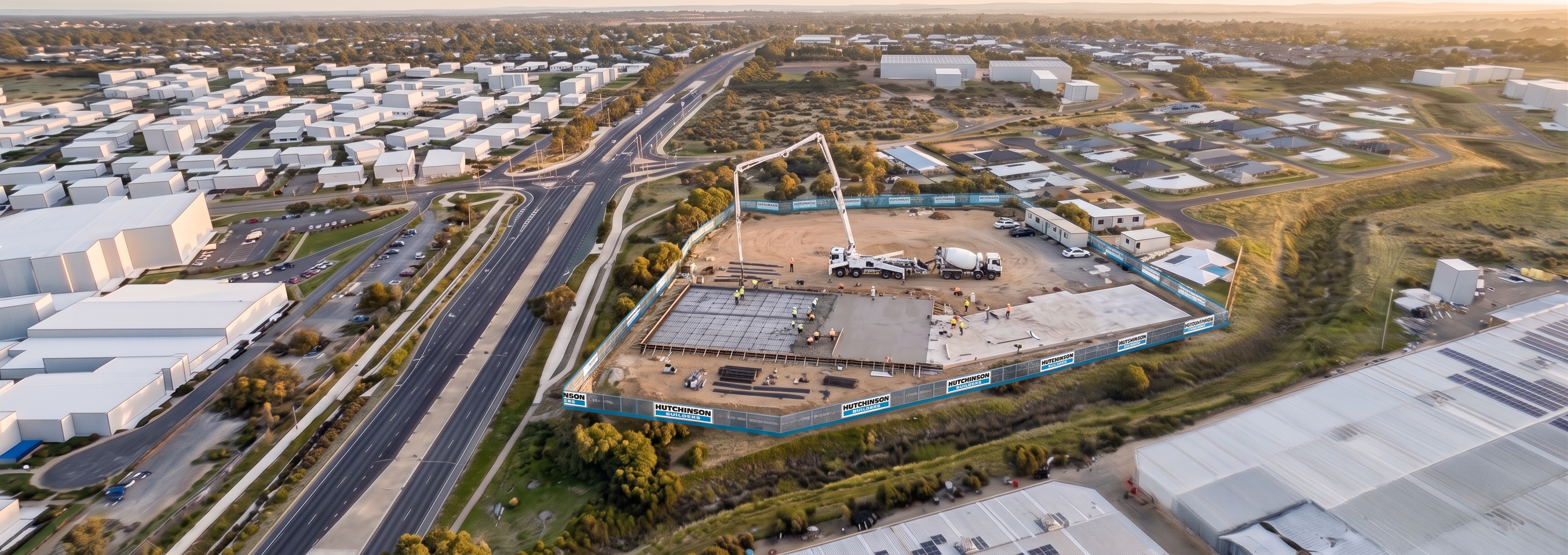
Using the supplied Demolition Render as the primary image and master reference, create the next construction sequence showing active concrete slab construction.

Critical Reference Hierarchy

Demolition Render = Camera, Perspective and Background Reference

The demolition render is the source of truth for:

Camera position
Camera height
Camera angle
Field of view
Perspective
Site fencing
Roads
Landscaping
Neighbouring houses
Industrial buildings
Drainage corridor
Lighting
Shadows
Overall image composition

Everything outside the construction footprint must remain identical to the demolition render.

Slab Planning Image = Slab Location Reference Only

The slab planning image is provided for one purpose only:

Identify the exact position of the building footprint.
Identify the exact location of the concrete slab.

Do not use the slab planning image to determine:

Camera angle
Perspective
Building style
Background
Lighting
Site context

The slab planning image is location guidance only.

Camera Lock

The output image must use the exact same viewpoint as the demolition render.

Do not:

Change camera angle.
Change camera height.
Change camera direction.
Zoom in.
Zoom out.
Crop the image.
Reposition the site.

The finished image should look like the demolition render taken from the exact same drone location.

Construction Progress

Demolition is complete.

Earthworks are complete.

The project is now in the slab construction phase.

Construct the slab only within the footprint shown in the slab planning image.

Do not introduce any slab outside that footprint.

Slab Construction Activities

Show:

Concrete slab approximately 60-70% complete.
Freshly poured concrete.
Reinforcement mesh visible in remaining unpoured areas.
Concrete pump truck.
Concrete agitator trucks.
Pump boom extended over active pour area.
Workers placing and finishing concrete.
Slab formwork.
Small steel reinforcement stockpiles.

Construction activity must occur only within the nominated slab footprint.

Retain Existing Site Features

Retain exactly:

Hutchinson Builders fencing.
Site entrance.
Existing roads.
Existing vegetation.
Drainage corridor.
Residential neighbourhood.
Industrial buildings.
Lighting and shadows.
Existing site establishment elements.

No other site changes are required.

Most Important Instruction

Create the image by updating the demolition render only. Do not create a new scene. Do not change the camera position, perspective, background, fencing, roads or surrounding context. The only significant change should be replacing demolition works with active concrete slab construction located exactly where shown in the slab planning reference image.

Success Criteria

A side-by-side comparison with the demolition render should show:

✅ Same camera location
 ✅ Same road alignment
 ✅ Same neighbourhood background
 ✅ Same fencing location
 ✅ Same lighting
 ✅ Same perspective

The only major difference should be that demolition activities have been replaced by a concrete slab pour located exactly within the footprint shown on the slab planning image.

"Treat this as an image editing task, not a new image generation task. Modify only the construction activities inside the site boundary and preserve all existing perspective and background conditions from the demolition render."

Create renders like this

Turn any photo, sketch, or floor plan into a photoreal render in seconds.