Skip to content
Render tools

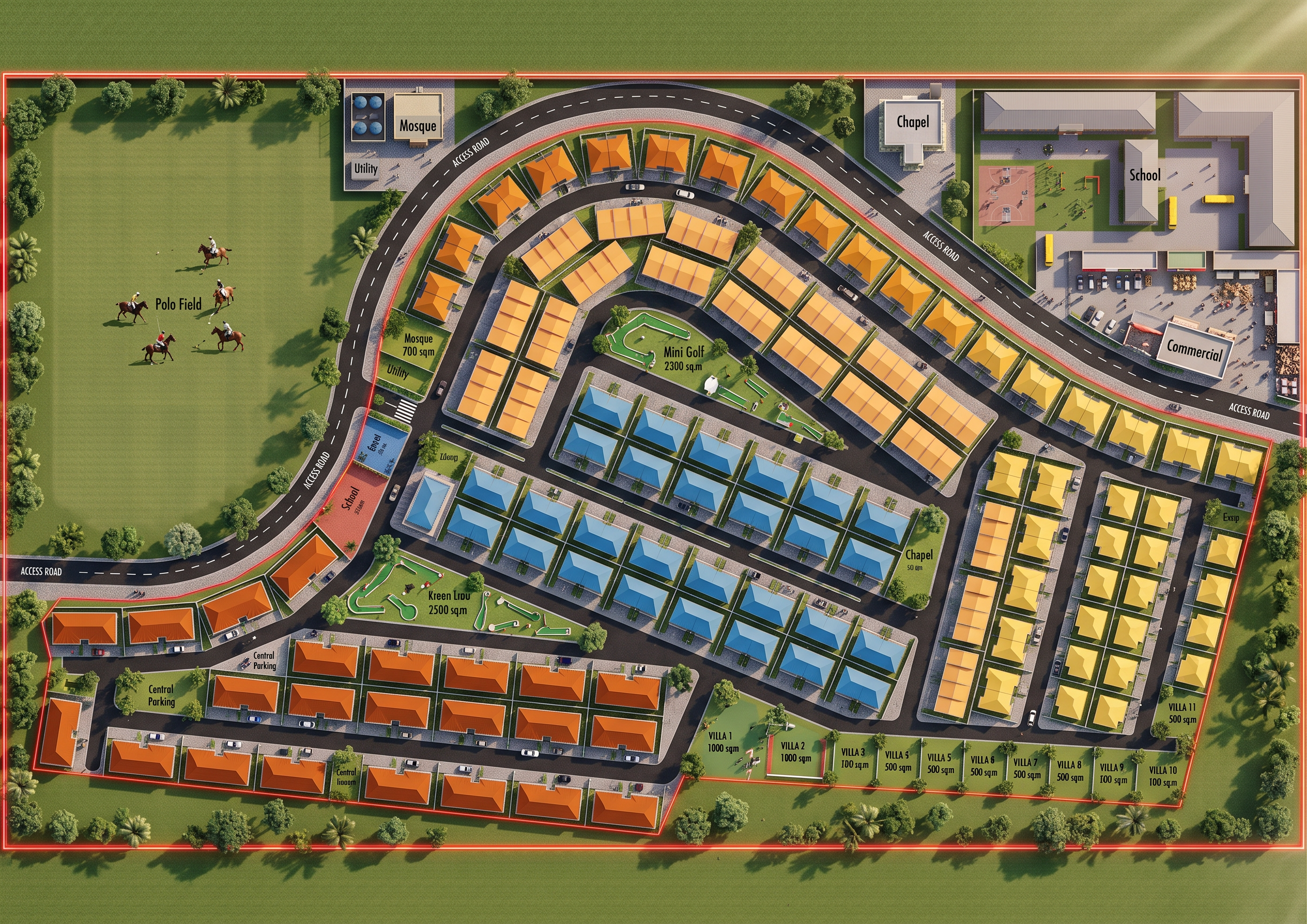
Use the uploaded PDF site layout plan as the base reference and generate a highly realistic rendered master plan while strictly preserving all geometry and zoning.

IMPORTANT — Preserve Drawing Information:
* Maintain the red boundary line exactly as the site limit
* Maintain all black lines as roads, plots, and layout divisions
* Preserve the FOUR housing types exactly as color-coded in the PDF
* Keep all text labels indicating commercial, school, and utility zones
* Do not modify plot sizes, road widths, or layout structure

Rendering Style:
* Realistic aerial masterplan view (BIRD EYE)
* Clean professional real estate developer presentation
* High resolution

Add Realistic Elements:
* Asphalt roads with lane markings based on black road lines
* Paved sidewalks along roads
* Street trees evenly spaced
* Residential buildings placed within each housing color zone
* Different building styles for each housing type (but retain color coding)
Polo activities in area marked polo field. 
Golf activities in the mini golf course
Sports activities in area with sports like activities 
* Commercial buildings in areas labeled "Commercial"
* School campus buildings with in area labeled "School"
* Utility areas rendered subtly (transformer, water tank, etc.)
* Green landscaping in open spaces
* Cars in parking areas and along roads
* Pedestrian figures for scale

Color & Visual Rules:
* Keep original housing color coding visible and dominant
* Do not recolor the zoning
* Roads in dark asphalt tone
* Landscape areas in natural green
* Buildings in soft realistic tones matching zone color

Environment:
* Soft daylight shadows
* Clean Nigerian residential estate setting
* Flat terrain unless otherwise indicated
* Professional planning board style

Output:
* Ultra-realistic rendered site plan
* Clear readable zoning
* No distortion of the planning drawing
* Presentation-ready masterplan visualization

Create renders like this

Turn any photo, sketch, or floor plan into a photoreal render in seconds.