Skip to content
Render tools

You are a professional urban planning visualization expert.

I am uploading:

1. My original master plan.
2. A reference image.

The reference image is ONLY for the presentation style, colors, road hierarchy, textures, shadows and graphic quality.

DO NOT copy its layout.

DO NOT redesign my project.

══════════════════════════════════════

IMPORTANT

This is NOT a conceptual design.

This is NOT a new master plan.

This project is already fully designed.

Preserve my master plan exactly.

Do NOT:

• Change any road.
• Move any service.
• Change plot boundaries.
• Change block sizes.
• Change the urban layout.
• Simplify the residential area.
• Add new roads.
• Remove internal streets.
• Invent buildings.
• Replace residential land with agriculture.
• Replace agriculture with residential land.

If something is unclear, leave it unchanged instead of guessing.

══════════════════════════════════════

RESIDENTIAL DISTRICT

The residential city is the main focus.

The residential district must appear realistic and detailed.

Each residential plot contains only ONE Single-Family Villa.

The remaining plot area is:

• Private Garden
• Trees
• Landscape
• Grass
• Walkways

The residential area should feel luxurious, green and low-density.

Show:

• Villas
• Internal streets
• Sidewalks
• Pedestrian paths
• Trees
• Gardens
• Parking spaces
• Landscape

Keep every internal street exactly as drawn.

══════════════════════════════════════

ROAD NETWORK

Keep the exact road network.

Do not simplify the streets.

Clearly distinguish the hierarchy.

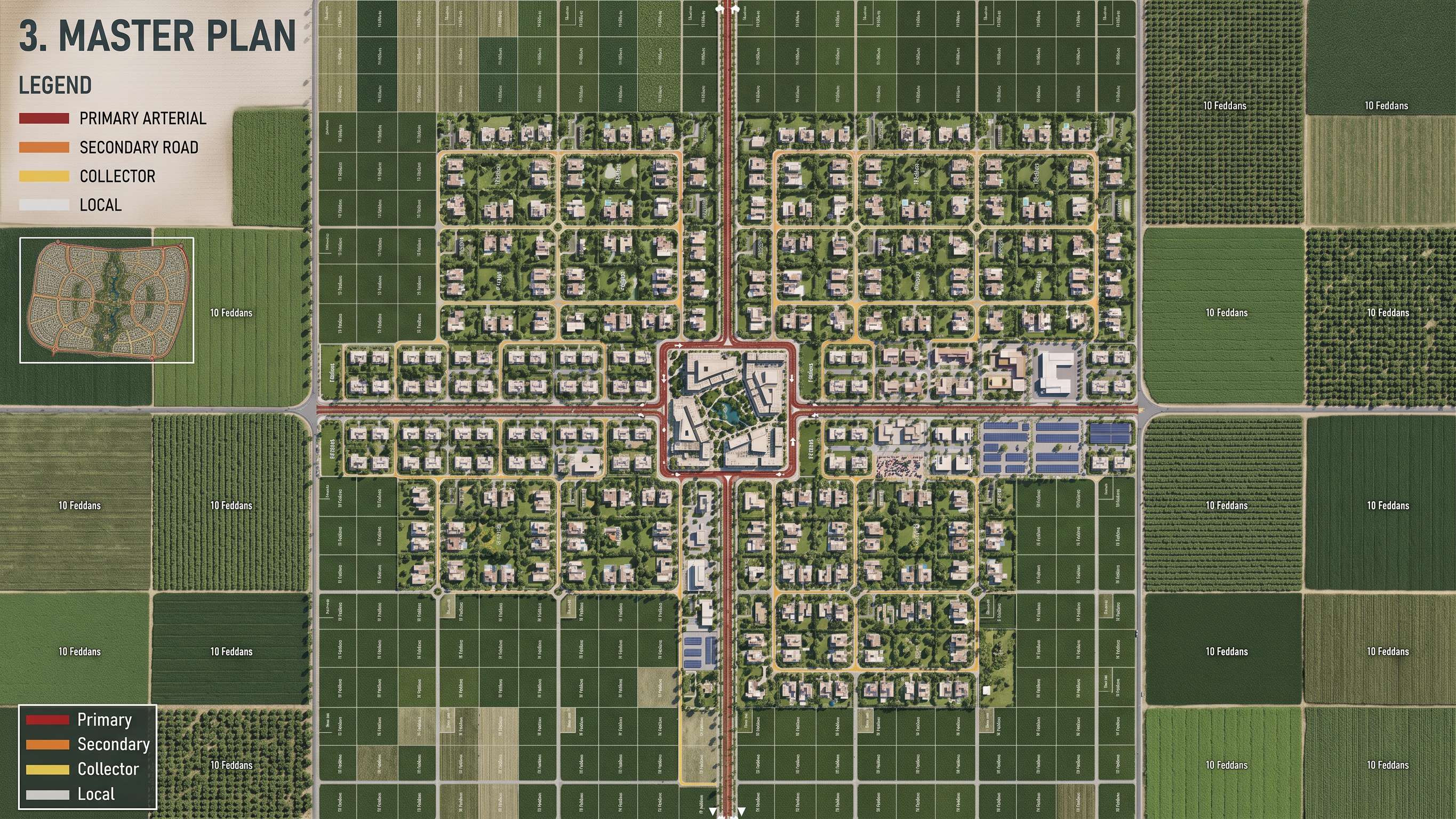
Primary Roads → Deep Red

Secondary Roads → Orange

Collector Roads → Yellow

Local Roads → Light Gray

Show:

• Lane markings
• Sidewalks
• Roundabouts
• Entrance arrows
• Exit arrows

The road hierarchy should remain visible without hiding the realistic rendering.

══════════════════════════════════════

AGRICULTURAL LAND

Everything surrounding the residential city is agricultural land.

Keep every agricultural parcel exactly as drawn.

Apply realistic agricultural textures.

Different shades of green.

Keep parcel boundaries visible.

Label each parcel:

10 Feddans

Do NOT generate houses inside agricultural land.

══════════════════════════════════════

SERVICES

Keep every service exactly in its original location.

Do NOT relocate:

• Central Park
• Mosque
• School
• Commercial Center
• Solar Power Plant
• General Hospital

Never guess any service location.

══════════════════════════════════════

VISUAL STYLE

Create a premium urban master plan presentation.

Combine:

• Realistic residential rendering

with

• Professional road network graphics.

Use:

Soft shadows

Realistic asphalt

Beautiful landscape

Street trees

Clean sidewalks

Professional typography

Elegant colors

Architectural presentation quality

The residential city must be highly detailed and realistic.

The road hierarchy must remain clear.

The agricultural land should appear realistic but remain secondary.

The final result should look like an international urban planning competition presentation while preserving my original master plan exactly.
The residential district is the primary focus of this rendering.

Allocate most of the rendering detail to the residential city.

Show detailed villas, private gardens, internal streets, sidewalks, pedestrian paths, trees, lighting, and landscape.

The surrounding agricultural land should remain simple and secondary.

The road hierarchy must remain visible without reducing the realism of the residential area.

Create renders like this

Turn any photo, sketch, or floor plan into a photoreal render in seconds.