- Prompt
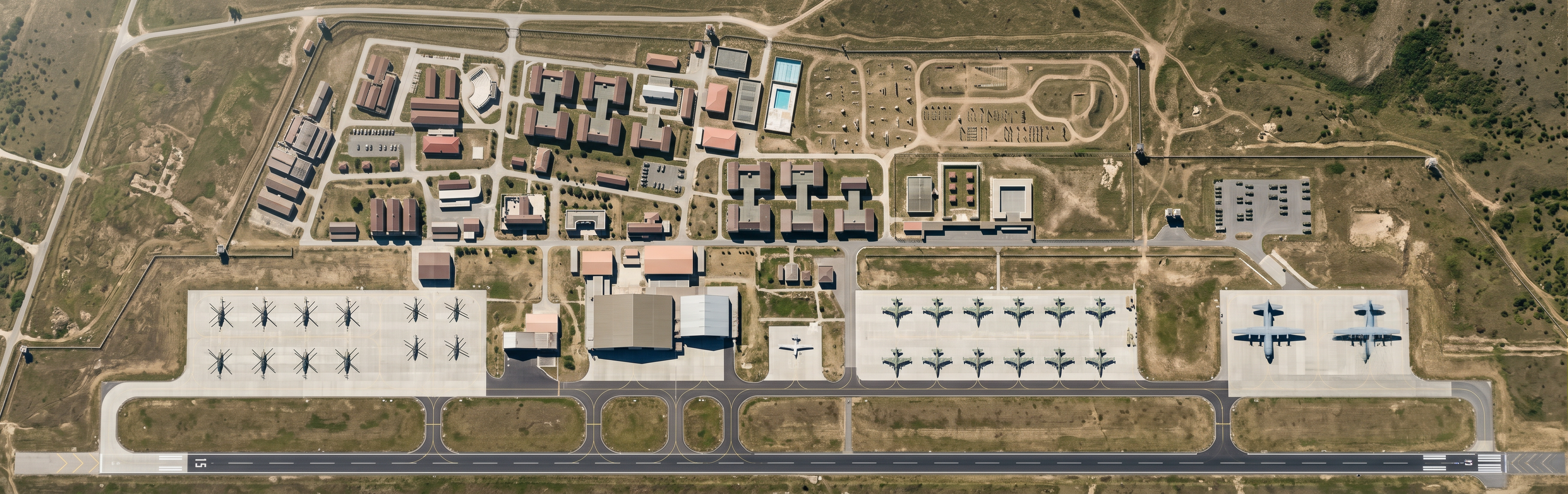
- Convert the uploaded airport site plan into a realistic 3D aerial architectural visualization. Use the uploaded image as the fixed geometric reference.
THIS IS AN IMAGE-TO-IMAGE VISUALIZATION TASK, NOT A DESIGN TASK.
PRESERVE THE EXISTING LAYOUT. Do not redesign, invent, simplify, move, resize, rotate, replace, or rearrange any existing element.
GEOMETRY:
Keep the exact runway alignment, length, width, markings and boundaries. Preserve every taxiway, junction, fillet, apron, road, parking area, site boundary and building footprint in its original position and shape. The pink building outlines define fixed building footprints. Extrude buildings vertically from these exact footprints without changing their ground-level geometry.
MATERIALS:
Dark pavement areas are asphalt. Light-gray pavement areas are concrete. Keep every pavement boundary and connection unchanged.
AIRCRAFT:
Show exactly 8 helicopters on the leftmost apron; 1 Bayraktar UAV on the next apron to the right, in front of the hangar; 10 Su-25 aircraft on the next apron; and 2 C-130 aircraft on the next apron. Preserve any existing aircraft positions and orientations. Never add aircraft to other areas or rearrange the designated groups.
LANDSIDE:
Preserve the exact layout of the facilities for approximately 3,500 military personnel. The upper-right areas must be identified as PENTATHLON AREA and MILITARY OBSTACLE COURSE. Do not turn the obstacle course into a forest or landscaped park. Do not add decorative trees, new buildings, roads, parking lots, or other infrastructure.
3D APPEARANCE:
Add realistic building height, roof and facade materials, physically plausible shadows, asphalt and concrete textures, and restrained daylight. Use a high aerial, almost vertical top-down camera with minimal perspective distortion. Keep the entire site and both runway ends visible.
NO NEW DESIGN ELEMENTS. NO LANDSCAPING INVENTED BY AI. NO GEOMETRIC CHANGES. NO CROPPING. NO ADDITIONAL AIRCRAFT.
The final output must look like a professionally rendered 3D airport masterplan built from the original drawing, not a newly imagined airport.
PRIORITY ORDER:
1. Preserve the original geometry.
2. Preserve every building footprint and pavement boundary.
3. Preserve aircraft quantities and apron assignments.
4. Improve realism through materials, vertical height, lighting and shadows only.
If a visual enhancement conflicts with the uploaded plan, preserve the uploaded plan.
- Created
- October 19, 2026
- Seed
- 0