- Prompt
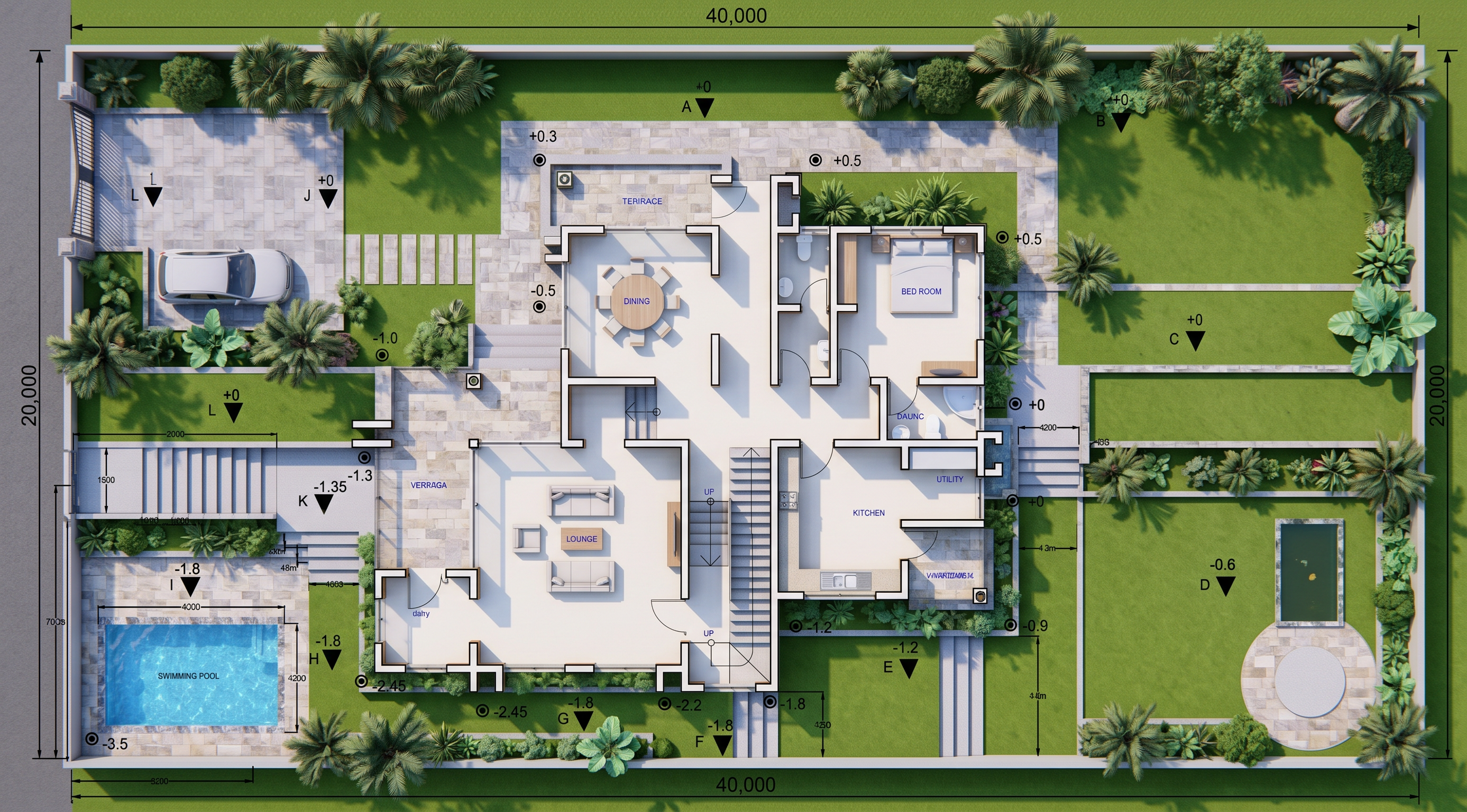
- Pure top-down aerial landscape masterplan, approximately 90-degree overhead view. Preserve the uploaded site plan geometry exactly. Show the existing house footprint and the proposed stepped landscape terraces exactly in their indicated locations. Clearly communicate the different terrace levels through changes in terrain, retaining walls, stairs, paving, lawns and planting. Preserve all property boundaries and major dimensions. Realistic tropical residential landscaping, natural lawn, trees, shrubs, paved pedestrian paths and attractive retaining walls. Professional architectural landscape visualization. Entire property visible, centered composition, minimal perspective distortion, realistic daylight. Do not redesign or relocate the terraces, house, stairs or retaining walls. The main gate is at the top left corner of my sketch image the pergolas are facing the front side of the plot (terrace A). Terraces A, B, C, L and J are at the same level. Terrace D is at -0.6, E is at -1.2, F, G, H and are at -1.8 and K is at -1.35 as per shared drawing there are a total of only 5 staircases linking terraces with different levels
- Created
- October 1, 2026