- Prompt
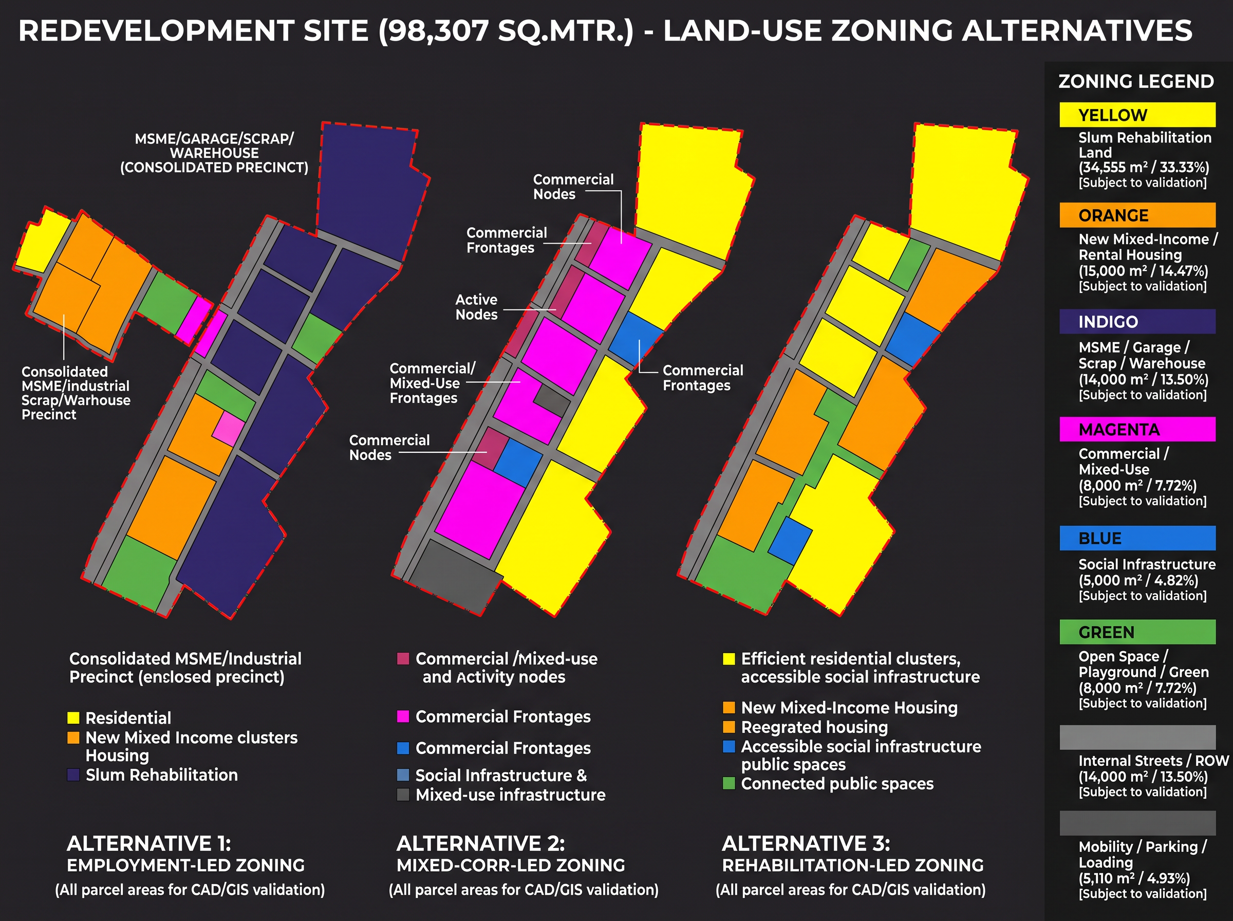
- Generate three distinctly different 2D urban land-use zoning alternatives for a 98,307 m² redevelopment site. Use my uploaded zoning map as the geometric reference.Explore three strategies:
Employment-led zoning, with a consolidated MSME/garage/scrap/warehouse precinct.
Mixed-use corridor-led zoning, with connected commercial frontages and activity nodes.
Rehabilitation-led zoning, with efficient residential clusters, accessible social infrastructure and connected public spaces.
Use flat solid colours, clearly separated parcels, a professional 2D orthographic top view, and a consistent legend. Show no trees, 3D buildings, textures, decorative landscaping or photorealistic rendering.
Produce separate alternatives rather than minor cosmetic variations. Do not invent parcel-area labels or claim exact area compliance unless the geometry has been measured. Mark all unverified areas for CAD/GIS validation.Slum rehabilitation land 34,555.33/32765.7 3.4555 33.33%
New mixed-income / rental housing 15,000.00/14225 1.5000 14.47%
MSME / garage / scrap / warehouse 14,000.00/13271.5 1.4000 13.50%
Commercial / mixed-use 8,000.00/7589.3 0.8000 7.72%
Social infrastructure 5,000.00/4738.4 0.5000 4.82%
Open space/playground / green 8,000.00/7589.3 0.8000 7.72%
Internal streets / ROW 14,000.00/13271 1.4000 13.50%
Mobility / parking / loading 5,110.67/4817 0.5111 4.93%
TOTAL 103,666.00/98307 10.3666 100.00%
- Created
- October 29, 2026