Skip to content
Render tools
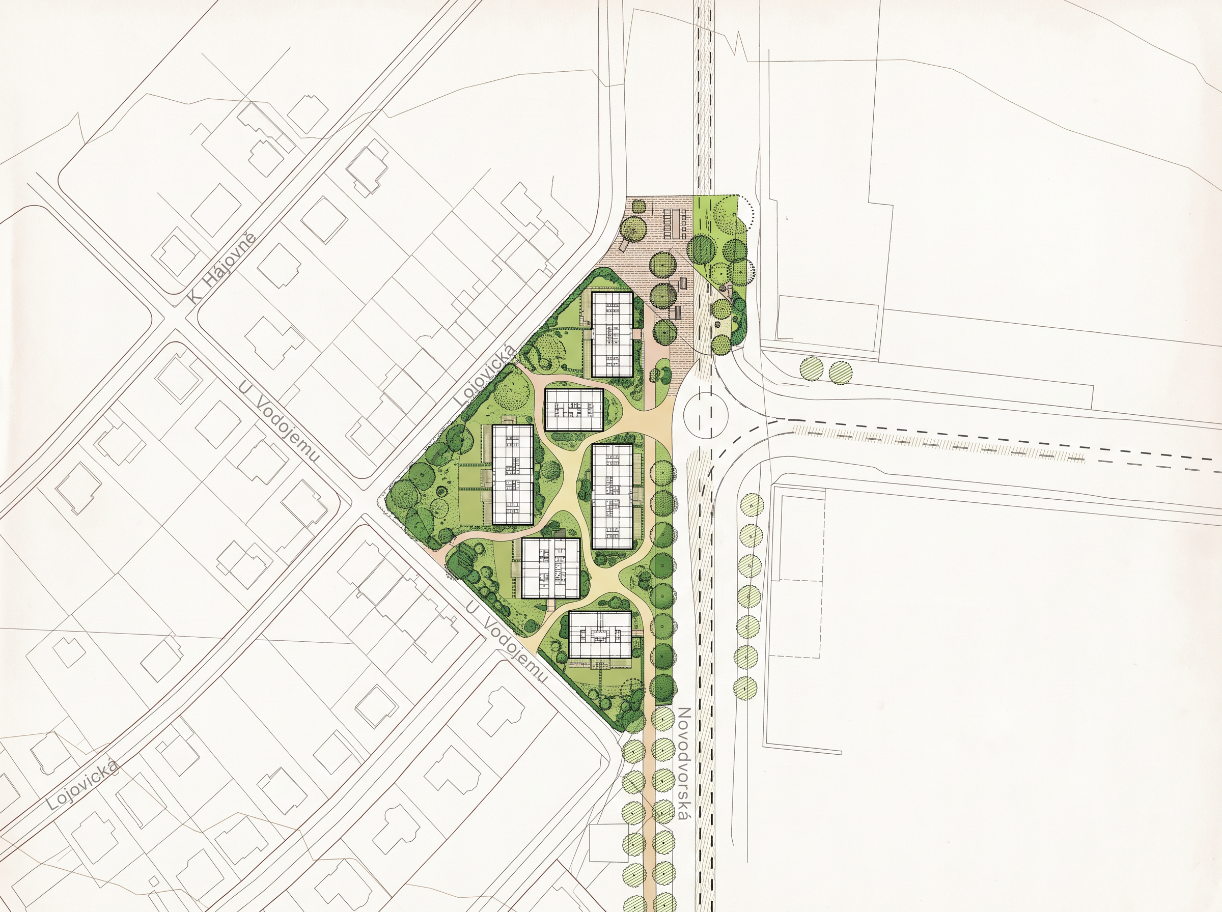
You are a top-tier urban planner and landscape architect. I have a working site plan for a residential project on a triangular plot in Nové Dvory, Prague, featuring my precisely placed buildings (the black rectangular masses in the attached CAD drawing). Do NOT change the positions, rotations, or dimensions of these buildings.

Using the attached master plan of the successful "Na Vackove" project (by UNIT architekti) as your primary design reference and style guide, your task is to design the urban public space, landscaping, and surroundings between my buildings.

DESIGN REQUIREMENTS BASED ON THE VACKOV REFERENCE:

1. MAIN PEDESTRIAN PATHS (MEANDERS):
- Design a network of gently curving, organic pedestrian paths that weave seamlessly between my buildings without cars. These paths should connect the eastern side (along Novodvorská street) with the western residential neighborhood (towards Lojovická).

2. VEGETATION GRADATION & UNBUILT GROUND (ROSTLÝ TERÉN):
- In the central courtyard area, create a generous oasis featuring a semi-public park with mature trees (represented by dotted circles/hatching). Ensure this central zone is free of underground parking beneath it, allowing for unbuilt ground (rostlý terén) with deep-rooting trees and natural rainwater infiltration.

3. FRONT GARDENS & SEMI-PRIVATE SPACES:
- Define strips of private front gardens along the longer facades of the ground-floor apartments, enclosed by low hedges or fences, exactly like the residential blocks in Na Vackove.

4. PUBLIC PLAZA / NORMALLY ACTIVE GROUND FLOOR (NORTHERN TIP):
- In the northern corner/tip of the site (near the roundabout), design a paved public piazza with an active ground-floor use (suitable for a cafe or local services), forming a welcoming gateway into the area.

Please describe this urban design layout structured step-by-step so that I can directly take it and draw it into my AutoCAD drawing as new layers for landscaping, walkways, and front gardens....dont add any text....do it in style of a site plan from autocad

Create renders like this

Turn any photo, sketch, or floor plan into a photoreal render in seconds.